
In this monthly feature, we span the globe to examine Our Changing Landscape with a time series of medium-resolution PlanetScope satellite imagery. The PlanetScope constellation dates back to 2016 and collects hundreds of millions of square kilometers of four and eight-band 3-meter imagery daily! In August, we headed to Saudia Arabia to see how the NEOM Campus changed from 2016 to present time. For the September edition of this series, we feature images of the Camp House Fire that broke out in northern Minnesota in May 2025.
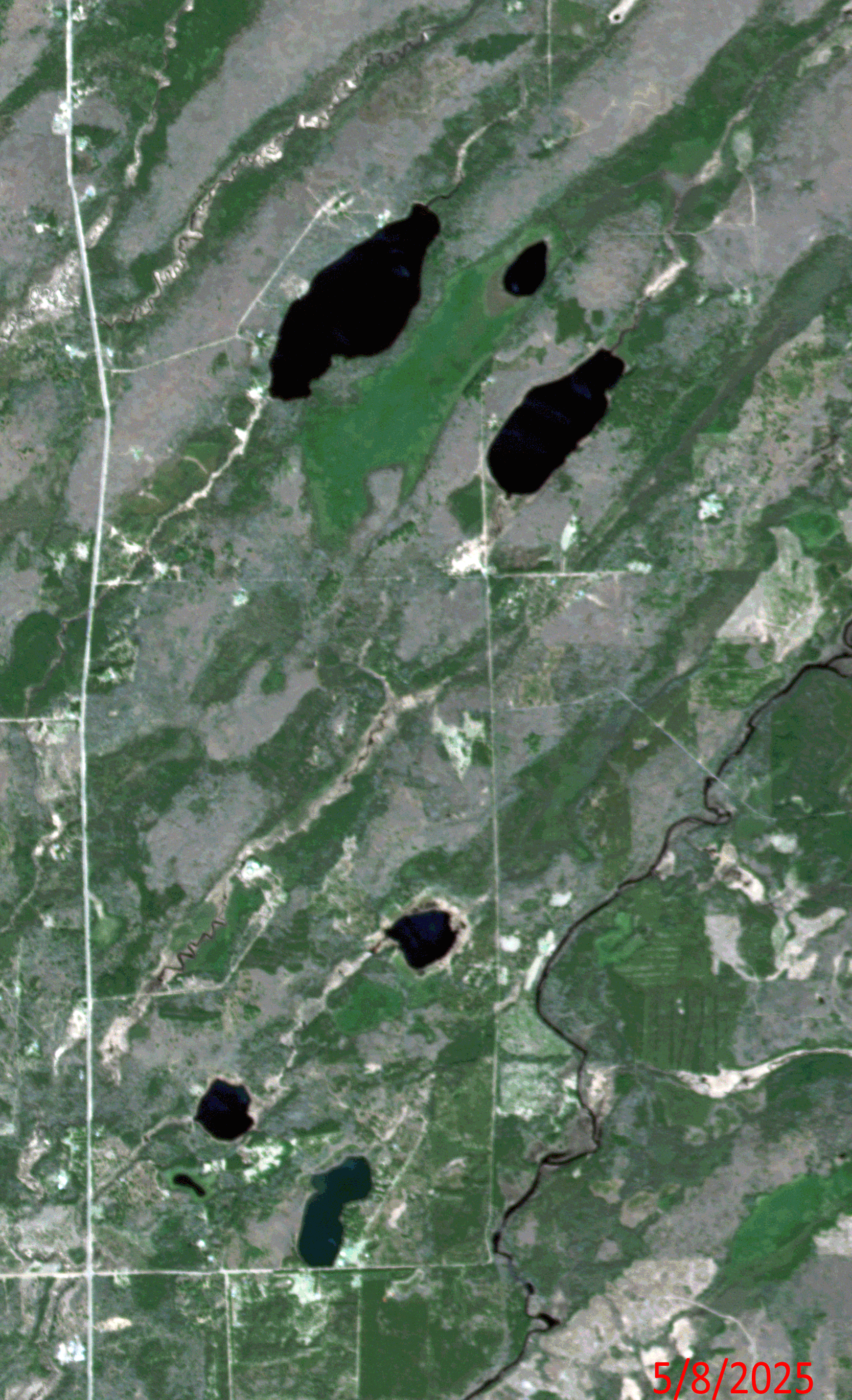 Click on the image above to see an animation of 3-meter natural color PlanetScope image collected over the Camp House Fire in northern Minnesota on May, 8, 12 and 19, 2025. In the May 8th image, you can see lush green agricultural fields here and then in the May 12th image, you can see several active burn sights from the Camp House Fire. By May 19th, the fires here have been put out, but you can see significant fire scars which have been left behind – we circled some of the worst damage in the final slide. (Images Courtesy: © Planet 2025)
The PlanetScope Microsat Constellation
PlanetScope is a constellation of more than 240 microsats referred to individually as Doves. Each Dove is able to collect up to 20,000 square kilometers (sq km) per day of 3-meter (m) 4-band multispectral (i.e. blue, green, red and near-infrared [NIR]) imagery; and newly launched SuperDoves collect 8-band multispectral adding in valuable red-edge spectral data. Across the constellation, PlanetScope is archiving more than 200 million sq km of medium-resolution imagery a day, making it the go to source for daily imagery over most locations. This massive archive dates back to 2016, offering the most complete and continuous record of spatial data on the planet since the start of the constellation’s ongoing launch schedule. Collecting 3-meter multispectral imagery is the equivalent of ‘high-resolution’ multispectral data imaged by a 75-centimer (cm) satellite (as this satellite would feature 75-cm panchromatic and 3-m multispectral), making PlanetScope an extremely competitively priced option at just $2.25 per sq km. With well registered images and nearly daily collections of most locations, PlanetScope is the ideal imagery source for this current-events focused series, Our Changing Landscape.
The 2025 Camp House Fire in Minnesota
Last month, three separate wildfires burned an estimated 37,000 acres in northern Minnesota. The Jenkins Creek Fire northwest of Duluth burned nearly 20,600 acres while the Camp House Fire – the first fire to be reported – torched nearly 15,000 acres. The Three Lakes/Munger Shaw Fire, the smallest of the trio, had spread to 1,700 acres, according to CBS News.
The fires destroyed dozens of structures positioned in their paths. The weather that typically rolls off the nearby lake posed problems for firefighters battling the blazes. Governor Tim Walz activated the Minnesota National Guard and its helicopters to help fight the fire. The fires also prompted the closing of part of the Laurentian Ranger District in Superior National Forest, meaning no visitors could enter campsites, trails and recreation sites. In Saint Louis County, 1,000 homes were evacuated ahead of the wildfires.
By the end of May, the Camp House wildfire was around 90% contained. The Eastern Area Incident Management Team said the fire initially started on private land and moved into the Superior National Forest. St. Louis County Sheriff Gordon Ramsay told Fox 9 it was started by a campfire that was left unattended. He added that the DNR has identified the person who started the fire. The St. Louis County sheriff also said the Jenkins Creek wildfire appears to have been started by a discarded cigarette along Highway 16 as it began near a roadway.
If you would like to find out more about using 3-meter PlanetScope imagery for your academic studies, engineering projects or any landscape analysis, let us know at sales@apollomapping.com or (303) 993-3863.

Leave a Reply