
Satellite Imagery for the Mining Industry
Over the years, Apollo Mapping has established a strong working relationship with repeat clients in the mining industry by providing fast, efficient and accurate imagery services. We work with 19 imagery providers operating 60+ satellite constellations from around the world to supply the most up-to-date, high-resolution remote sensing imagery for any mineral exploration or mining operations project. Our access to over 200 million+ high and medium-resolution satellite images combined with our lightening fast response times, increases the odds of finding the data you need for your mining project. And we always deliver it on time and according to your specifications!

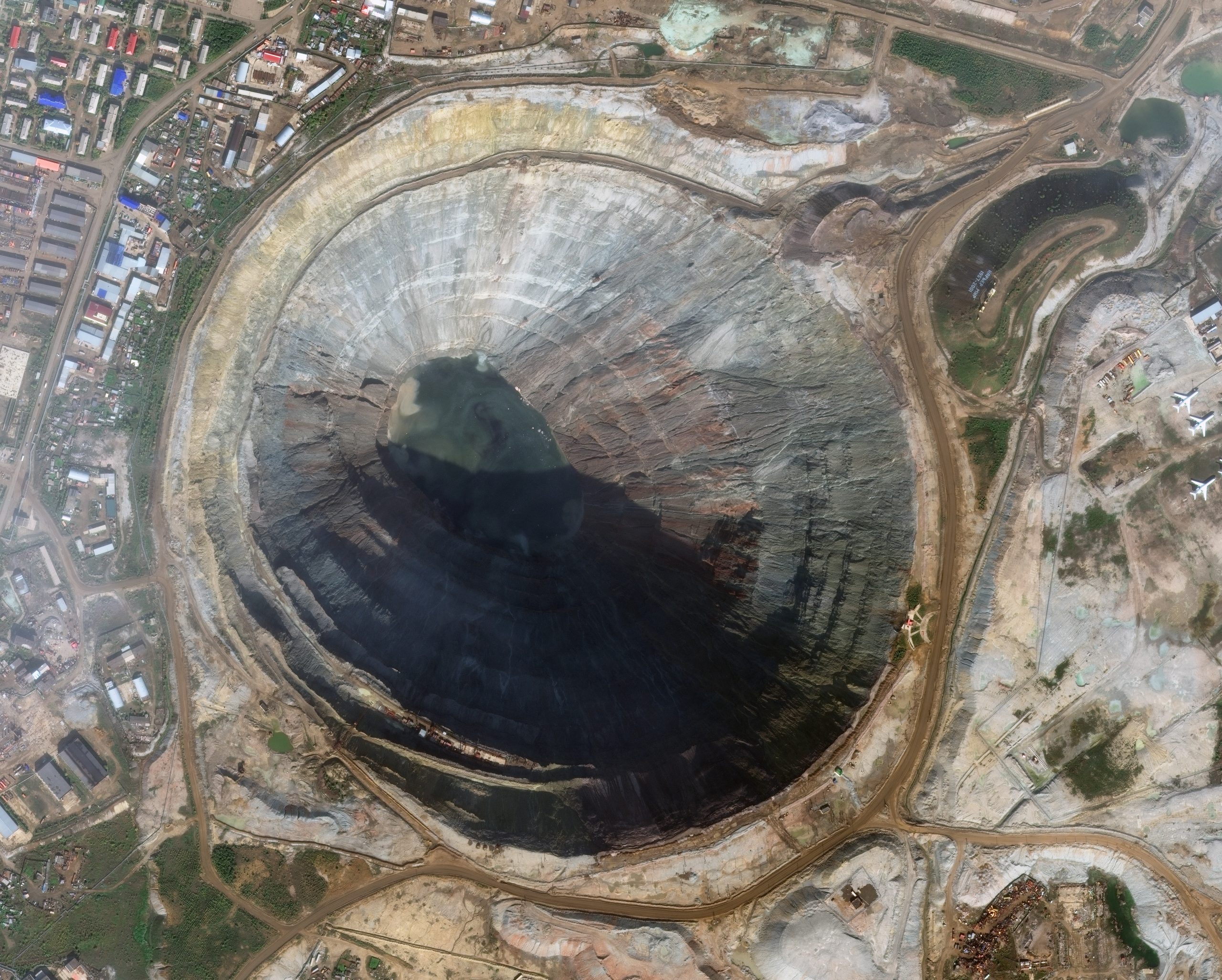
We’ve seen the many ways mining companies use our data to solve problems and plan for the future – here are a few of the most popular GIS, AutoCAD and remote sensing applications:
- Updated basemaps for your GIS and CAD that combine satellite imagery with existing vector layers for planning and initial exploration.
- Monitor mines with a time series of images for insight into mining activity as it evolves (or did evolve), from tracking infrastructure updates, to locating nearby land-use changes and assessing dig operations.
- Topographic mapping products such as digital elevation models (DEMs), contours and 3D models unveil the landscape, lending scale and perspective to your GIS and CAD drawings.
- Mineral exploration using 4-band and 8-band multispectral imagery in conjunction with 8-band WorldView-3 SWIR to help locate and estimate mineral reserves.
- Land-use and land cover analysis aids long-term planning operations, and helps to locate dangerous encroachment on active mining activities.
- Surface restoration benefits from our archive of historic satellite imagery to assure mine closures match original environmental and ecological conditions.
We can help you find the right data no matter where you are in the process, with fast delivery and attention to detail. Our goal is to offer our clients the most efficient, high-quality experience. Interested in finding out more?
Great! You can check out all 60+ satellite constellations and tens of millions of images on our search engine, Image Hunter, at any time of the day or night. With Image Hunter, you can define your region of interest (be it a mine or a mountain chain), adjust the filters to your specifications, then see all of the available imagery before easily submitting your selection for a quote. A representative will get right back to you with pricing from there.
Or if you prefer email, you can reach us directly at brock@apollomapping.com and .
