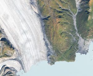
 In our ever changing world it’s important to have up-to-date spatial information. This is especially true when it comes to both urban and rural landscapes. Buildings and roads are constructed and demolished at a pace that is difficult to track. Satellite imagery lends context to these changes when time and distance are barriers to getting accurate information. With satellite imagery, our customers can see how their projects have changed over the years as well as the current state of affairs.
When you need location information for a project, time is of the essence. Each project is unique, with its own challenges. At Apollo Mapping, we understand that time wasted is money wasted. As experts in satellite and aerial imagery, we have all the knowledge to respond quickly and efficiently to each customer, no matter the scope of work. We pride ourselves on quick response times and even quicker delivery times. We are partnered with all the major (and minor) imagery providers to offer the largest possible selection to our customers.
Satellite and aerial imagery is available from a plethora of providers, each with their own search engine and vastly different specifications and qualities. Looking through each of these search engines would take days.
To that end, we developed the most extensive satellite imagery search engine on the market. Image Hunter pulls from 56 sensors, 19 satellite and aerial imagery providers and 117 million plus records with resolutions ranging from 15-centimeters to 30-meters.
Customers no longer need to rely on sales people to provide them with the best satellite imagery options for their location(s). There are no wait times and you have all the control.
Flexible Pricing
We know that pricing is a factor and can offer alternatives that fit into most budgets. For academic and non-profit users, we have discounted pricing. On top of traditional satellite imagery, we offer our customers digital elevation models (DEMs), 3-D data and night-time imagery.
What YOU Need
Pick the images at the resolution you need, in the time frame you need; and then with the click of a button, you can save your search and send your results to a colleague. Once you’ve decided on the imagery you want to order, it’s easy to request a quote from one of our Apollo Mapping specialists.
3 Hours or Less
Within three hours, you’ll have pricing and more information on the data you selected. Once you’re ready to place an order, we collaborate with our partners to deliver your imagery faster than anyone else in the industry. No order is overlooked and no customer is undervalued.
Beyond the Archive
If we don’t have the imagery you need in the archive, we can set up a new collection. Within a short period of time we can get fresh data over your area of interest. As your advocate, we make sure that your imagery is collected as soon as possible and that your order is not overlooked by satellite imagery providers.
You don’t have the time to become an expert in satellite imagery, so let us be your expert.


