More Satellites

Pléiades Neo Satellite

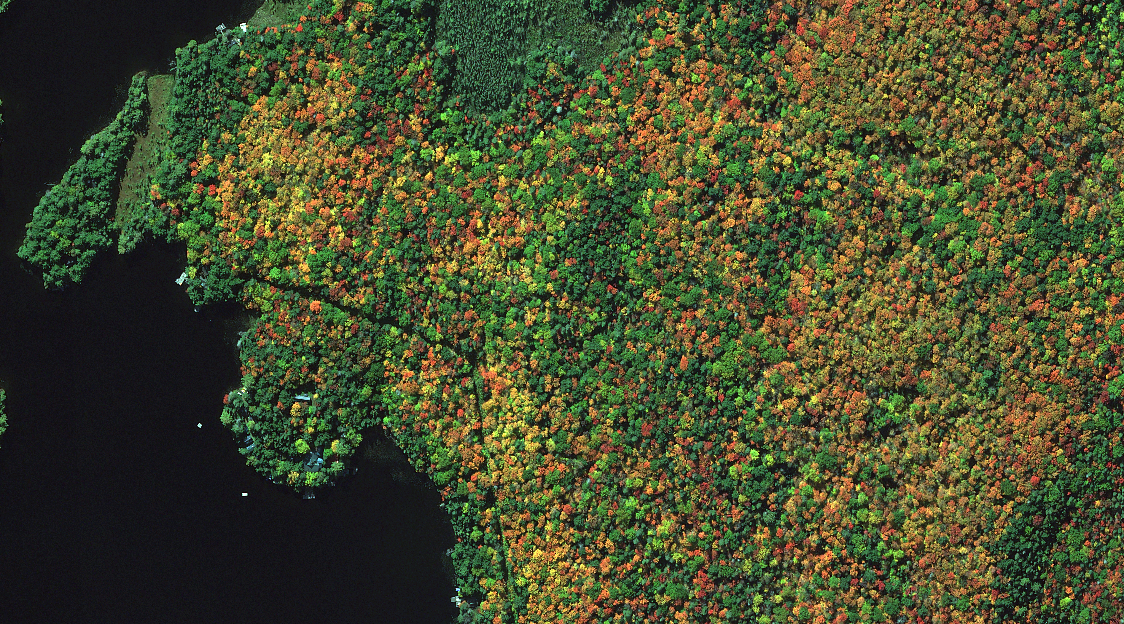
Pléiades Neo is Airbus' first 30-cm high-resolution satellite constellation collecting 6-band MS.

The Pléiades Neo Advantage

1 Million Sq Km Per Day

Between Neo 3 and Neo 4, the Pléiades Neo constellation captures up to 1 million sq km of 30-cm imagery every day.

6-Band Multispectral

Not only does Pléiades Neo have 30-cm resolution, it also provides six 1.2-m multispectral bands, including deep blue, blue, green, red, red edge and near-infrared.

Near Daily Revisits

The Pléiades Neo constellation is able to image nearly anywhere on the planet once per day.

Fully Commercial

Since Pléiades Neo reserves 100% of its capacity for commercial sales, clients won’t get muscled out by government contracts, thereby increasing the size of the 30-cm Neo imagery archive and shortening collection times.

Overview & History

PlĂ©iades Neo is the first constellation of two (originally planned for four) identical 30-centimeter (cm) satellites owned and operated by Airbus Defense and Space. Neo 3 launched on April 29, 2021 from Guiana Space Centre, Kourou, French Guiana and was followed soon after by Neo 4 on August 17th. Both PlĂ©iades Neo satellites will be on the same orbit, phased from each other–allowing for near daily revisits across the globe. The PlĂ©iades Neo constellation collects up to 1 million square kilometers (sq km) of imagery a day with a 14-kilometer swath width.

Along with the 30-cm panchromatic band, PlĂ©iades Neo boasts six 1.2-meter (m) multispectral bands, including deep blue, blue, green, red, red edge, and near–infrared. PlĂ©iades Neo is entirely open to commercial clients, with no government ownership of tasking time, thereby increasing its collection capacity.

Pléiades Neo Specifications

Launch Details
  • Launch Date: April 29, 2021, 01:50 UTC (PNeo 3); August 17, 2021, 01:47 UTC (PNeo 4)
  • Vehicle: Arianespace Vega rocket
  • Site: Guiana Space Centre, Kourou, French Guiana
  • Expected Mission Life: at least 10 years for each satellite
Pléiades Neo 3/4 Components
  • Satellite Mass: ~ 907 kg
  • Solar Array: dual-wing Gallium Arsenide (GaAs) panels, 150 Amp-hour (Ah) battery
  • Control Systems:
    • 3-axis stabilized
    • Actuators–four control movement gyros (CMGs)
    • Altitude determination–three star–trackers
    • Orbit determination–GNSS receiver
  • Onboard Storage Capacity: 14 terabytes (TB), solid state mass memory
  • Ground Communication Systems:
    • Imagery downlink–X-band, 2 channels, physical downlink rate of 1,124 Mbps
    • TT&C link–S–band, 2 antennas, uplink rate of 32 kbps and downlink rate of 533 Kbps
  • Optical Sensor Assembly:
    • NAOMIX camera, Korsch telescope with 3 folding mirrors
    • Aperture–910 mm (SNR)
    • Focal length–25.2 m (magnification)
  • Focal Plane:
    • Single pushbroom linear array, TDI instrument
    • Camera–12 detectors (6 panchromatic, PAN; 6 multispectral, MS)
    • Detectors: PAN–8,016 pixels, 12 µm detector size; MS–2,004 pixels x 6, 48 µm detector size
    • Image size: PAN–48,096 pixels (8,016 x 6); MS–72,144 pixels (2,004 x 6 x 6)
Orbit Characteristics
  • Altitude: 620 km
  • Period: 97.2 minutes
  • Inclination: 97.9°
  • Constellation Configuration: PlĂ©iades Neo operates as a genuine constellation with both satellites on the same orbit, phased from each other
  • Direction: sun–synchronous, north to south (across the lit side of Earth)
  • Equatorial Crossing Time: 10:30 AM local time (approximate; across lit side of Earth)
  • Maximum Constellation Revisit Frequency: (assumes full 4 satellite constellation; with only two satellites in orbit these collection times are theoretically halved)
    • Daily, anywhere (30° off nadir)
    • Twice daily, anywhere (46° off nadir)
Imaging System
  • Spectral Bands:
    • Panchromatic
    • 6-band multispectral (blue, green, red and near infrared [NIR] plus deep blue and red edge)
  • Sensor Resolution:
    • At nadir–30-cm panchromatic & 1.2-m multispectral
    • 20° off-nadir–33-cm panchromatic & 1.34-m multispectral
    • 30° off-nadir–39-cm panchromatic & 1.54-m multispectral
    • 45° off-nadir–56-cm panchromatic & 2.26-m multispectral
  • Spectral Band Wavelength Range: (in nm)
    • Panchromatic–450 to 800
    • Deep blue–400 to 450
    • Blue–450 to 520
    • Green–530 to 590
    • Red–620 to 690
    • Red-edge–700 to 750
    • NIR–770 to 880
  • Dynamic Range: 12-bits
Collection Capabilities
  • Footprint Width: 14 km (at nadir), 19.68 km (30° off-nadir)
  • Viewing Angle: ± 52°
  • Pointing Agility (roll/pitch): 10° in 7 seconds, 30° in 12 seconds, 60° in 20 seconds
  • Single Satellite Maximum Collection Geometry:
    • Target collection–image multiple targets (1 and 2): up to 13 targets within a 100×200 km area, in a corridor of +/-30 degrees
    • Strip mapping–large mosaics in a single pass (3): up to 70 x 110 km in the same pass (7,500 km²)
  • Retargeting Ability: up to 13 targets in a 100 x 200 km region with +/-30° off–nadir
  • Slew Time: 200 km in ~10 seconds
  • Daily Collection Capacity: up to 500,000 sq km per satellite, per day
  • Georeferenced Horizontal Accuracy: < 5-m CE90 (global average, dependent on terrain); expected 3.5-m CE90 with refined orbit data

Pricing

Below is the least expensive Pléiades Neo data offered. Prices increase for new collections and data processing. Note that academic and volume discounts are available.

Data Source:

archive

Minimum Order Size:

25 sq km (per area & date)

Product Type:

georeferenced + natural color, 4-band or 6-band

Looking for updated absolute radiometric characteristics of Pléiades Neo to be used in an atmospheric correction and/or radiance conversion?

Download Whitepaper

Find the imagery you need, your way.

Buy instantly online or
work with a satellite imagery expert.

From area of interest to delivered assets — typically within 24 hours.
Self-serve

Search & Order Instantly

Define your area of interest, compare results, and request pricing
— all in minutes.

Search satellite imagery

Best for experienced users who know what they need.

Done for you

Tell Us What You Need

Share your area, timeframe, and goals
— we’ll handle the rest.

Request expert assistance

Ideal if you’re unsure which imagery is right for your project.