
In this monthly feature, we span the globe to examine Our Changing Landscape with a time series of medium-resolution PlanetScope satellite imagery. The PlanetScope constellation dates back to 2016 and collects hundreds of millions of square kilometers of four and eight-band 3-meter imagery daily! In July, we looked at the destruction caused by a 7.7 magnitude earthquake in Myanmar that struck the region on March 28th. For the August edition of this series, we are heading to Saudi Arabia to look at the NEOM Campus and surrounding area as it changed it from 2016 to present time.
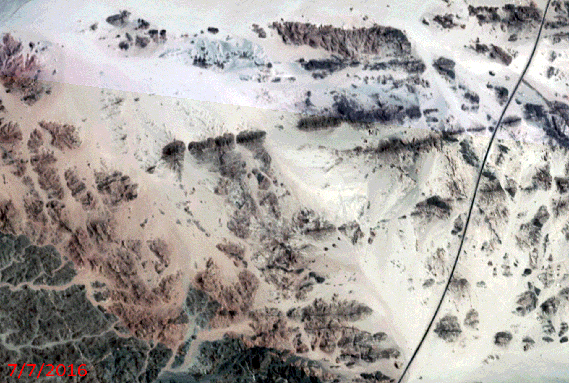 Click on the image above to see an animation of 3-meter natural color PlanetScope image collected over the NEOM Campus area in Saudi Arabia on July 7, 2016, August 31, 2020, December 24, 2022, July 16, 2024, and then March 27, 2025. In this animation, you can see how quickly the NEOM campus has grown in the past three years as compared to the period from 2016 to 2022. If you look at the southern part of the animation, you can also see progress on the construction of NEOM’s linear city which is a massively long, linear structure. Also, you can see just how remote this area was before the construction of NEOM started, which is very sad indeed. (Images Courtesy: © Planet 2025)
The PlanetScope Microsat Constellation
PlanetScope is a constellation of more than 240 microsats referred to individually as Doves. Each Dove is able to collect up to 20,000 square kilometers (sq km) per day of 3-meter (m) 4-band multispectral (i.e. blue, green, red and near-infrared [NIR]) imagery; and newly launched SuperDoves collect 8-band multispectral adding in valuable red-edge spectral data. Across the constellation, PlanetScope is archiving more than 200 million sq km of medium-resolution imagery a day, making it the go to source for daily imagery over most locations. This massive archive dates back to 2016, offering the most complete and continuous record of spatial data on the planet since the start of the constellation’s ongoing launch schedule. Collecting 3-meter multispectral imagery is the equivalent of ‘high-resolution’ multispectral data imaged by a 75-centimer (cm) satellite (as this satellite would feature 75-cm panchromatic and 3-m multispectral), making PlanetScope an extremely competitively priced option at just $2.25 per sq km. With well registered images and nearly daily collections of most locations, PlanetScope is the ideal imagery source for this current-events focused series, Our Changing Landscape.
Big Changes On The NEOM Campus And Surrounding Area
NEOM is a futuristic city-state under construction in northwest Saudi Arabia, encompassing a vast area with multiple regions and planned developments. It’s a key component of Saudi Arabia’s Vision 2030, which aims to diversify the economy and create a sustainable future. NEOM includes a variety of sectors, including a gaming campus, education, and a hub for media and production.
Launched in 2017 by crown prince Mohammad bin Salman, the site is at the northern tip of the Red Sea, due east of Egypt across the Gulf of Aqaba and south of Jordan. Multiple regions are planned, including a floating industrial complex, a global trade hub, tourist resorts, and a linear city powered by renewable energy sources.
Supporters hope the city will be completed by 2030, with the upcoming Saudi VISION 2030 around the corner, but some aren’t sure it will be done by then. In 2024, the Sindalah project was completed, three years after schedule and at three times its initial cost. The project’s estimated costs exceed $8.8 trillion (more than 25 times the annual Saudi budget), organizers say.
If you would like to find out more about using 3-meter PlanetScope imagery for your academic studies, engineering projects or any landscape analysis, let us know at sales@apollomapping.com or (303) 993-3863.

Leave a Reply