
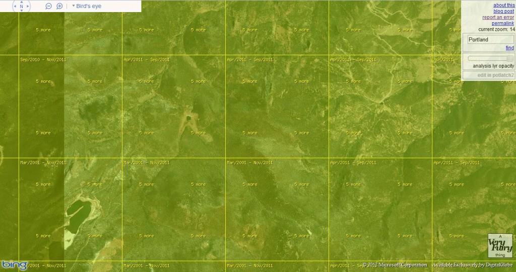
Have you ever been on Bing Maps and wondered, “What is the date of the imagery in this location?” Well I know I definitely have and according to the maker of the Bing Aerial Imagery Analyzer, Martijn van Exel, there is now a way to find these dates out. The Bing Aerial Imagery Analyzer is a slick API that lets you zoom in and out and then shows the ‘known’ date of the imagery – by tiles – that is currently loaded in Bing Maps.
While we all use applications like Bing Maps and Google Earth in the daily course of our jobs and/or studies, we should recognize them for what they are, i.e. ways to advertise to us and GIS-lites. We should also recognize them for what they are not, i.e. an imagery gathering application with 100% correct metadata. The reason I bring this up is that there will certainly be errors with the imagery dates in this application; and this is even addressed in this blog by the maker. That said, if you know the limitations up front, this is still a pretty slick application!
Until my next edition of Free For All!, happy hunting for free GIS data!
Brock Adam McCarty
Map Wizard
(720) 470-7988

This no longer works.
The date is not showing.
Cant it be fixed?