
Spring in my town means it’s time to look at the sky on an early morning in May for balloons. The annual Hot Air Balloon Festival comes to town with almost 50 balloons and a fun festival atmosphere for the weekend. Many years ago, I had the opportunity to ride in a hot air balloon. It’s an amazing experience! For just a moment, you’re transported back in time to a 19th Century version of “The Amazing Race” with Phileas Fogg and Passepartout floating over the countryside. Did you know that aerial photography is the earliest form of remote sensing? The French photographer and balloonist Gaspard-Félix Tournachon, known as “Nadar”, snapped the first aerial image in 1858 over Paris, France. Viewing the Earth’s surface from above, he wrote, “reduces all things to their relative proportions – to the Truth.” He pioneered artificial lighting in photography while working in the Paris catacombs, becoming the first to photograph both from balloons and underground. While the first aerial photo of Paris is lost, he sparked a zeal to see the world from above. The oldest surviving aerial photo is from the 1860’s of Boston taken in a balloon at 2,000 feet.
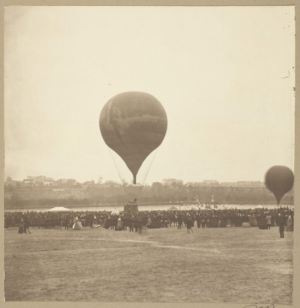 Nadar’s Balloon that took the first aerial photograph, “Le Geant, Champ de Mars, October 18, 1863”, probably printed 1880/89. (CC0 Public Domain Designation)
Remote sensing matured through aerial reconnaissance in World Wars, ultimately evolving into satellite-based earth observation in the 1960s. Other milestones include the 1972 launch of Landsat and the adoption of digital imaging, allowing for modern environmental monitoring and mapping. Can you imagine how magical your iPhone would be to Nadar if he saw us casually pulling up our route or zooming to a coffee shop on our handheld maps today?
That magical imagery has led to several discoveries. Remote sensing has revolutionized Earth observation, enabling discoveries like rapid glacier shrinkage in Patagonia, 90% volume loss in Walker Lake, and the detection of hidden archaeological structures using LiDAR, such as under the Cambodian jungle. Three discoveries in particular used remote sensing and other geospatial technologies to solve some world mysteries: the burial site of Genghis Khan, Amelia Earhart’s crash site, and newly revealed Mayan settlements.
Genghis Khan, a brilliant warrior and ruler, unified Mongolia’s nomadic tribes into a disciplined military state led by his family. He launched campaigns that extended the Mongol Empire from China’s Pacific coast to the Adriatic Sea. Dr. Albert Lin became interested in his personal heritage that led to his work using geospatial technologies to find the long hidden and mysterious burial place of the famous ruler, Genghis Khan. How do you decide where to start looking for something ancient? Crowdsourcing, or human computation, was part of the journey. I was fortunate to see Dr. Lin tell his story at Bishop Dunne high school in Dallas, TX as part of their 2013 GeoTech Conference. To find the ancient site without disturbing any land, people scanned imagery for something that “looks weird there.” The “weird” places led him to a moment where he’s walking on an ancient roof, completely swallowed by the landscape.
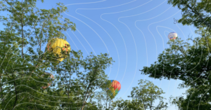 Balloons flying over my home. (By Barbaree Duke, 2024)
Dr. Lin isn’t the only person leveraging geospatial technology to solve an old mystery. What happened to Amelia Earhart? In 1928, she became the first female passenger to cross the Atlantic by plane. In 1932, she was the first woman to fly solo nonstop across the Atlantic and received the Distinguished Flying Cross. She promoted commercial aviation, authored best-selling books, and helped establish the Ninety-Nines, a group for women pilots. On July 2, 1937, she vanished over the Pacific Ocean while attempting a global flight as the first female pilot. According to an article in Popular Mechanics, Justin Myers, a pilot, used Google Earth and curiosity to solve part of the mystery. He’s not the only one to believe that she might have crash landed and survived on a small island.
Zoom from the Pacific Ocean over to Mexico. Tulane University doctoral student Luke Auld-Thomas has been part of another notable discovery. He realized that rather than hacking his way through the jungles, he needed Lidar imagery to make accurate measurements. Instead of costly new images, he sought out old and freely available imagery to complete his research. What he found in the process was a new Mayan city, Valeriana.
A new city, a modern mystery, and ancient history…all found with a photograph. It takes our human perspectives to research and interpret the mystery. We’re uniquely equipped to analyze patterns, especially if you’ve spent any time working with geospatial technologies. The proof we needed was quite literally in the pictures! If you need me, I’ll be volunteering at the balloon festival!
Barbaree Duke
Geospatial Crusader

Leave a Reply