
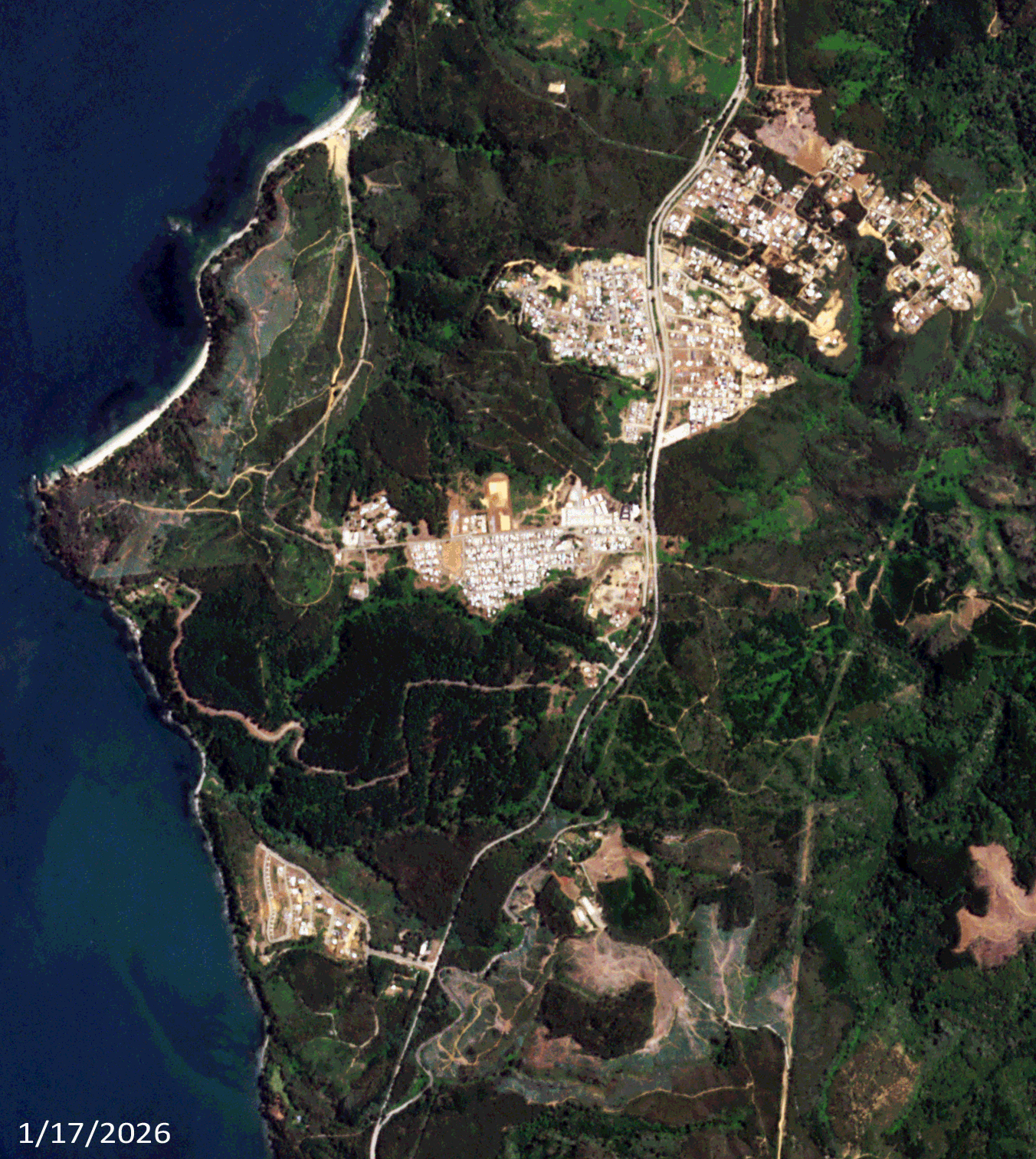
 Click on the image above to see an animation of 3-meter natural color PlanetScope image collected over Tome and Lirquen, Chile on January 17 and 21, 2026. In this animation, you can see how much vegetation was burnt during this large fire as there are very few pockets of greenery left in the January 21st image. In the third slide, we have circled one particularly devastated neighborhood known as Punta de Parra where nearly every building looks to have been destroyed. Our hearts go out to these communities as they rebuild from this destruction. (Images Courtesy: © Planet 2026)
In this monthly feature, we span the globe to examine Our Changing Landscape with a time series of medium-resolution PlanetScope satellite imagery. The PlanetScope constellation dates back to 2016 and collects hundreds of millions of square kilometers of four and eight-band 3-meter imagery daily! In April, we checked out Bolivia’s Salar de Uyuni, also known as the salt flats. For the May edition of this series, we are look at a January 2026 wildfire in Chile that destroyed homes and stole lives.
The PlanetScope Microsat Constellation
PlanetScope is a constellation of more than 240 microsats referred to individually as Doves. Each Dove is able to collect up to 20,000 square kilometers (sq km) per day of 3-meter (m) 4-band multispectral (i.e. blue, green, red and near-infrared [NIR]) imagery; and newly launched SuperDoves collect 8-band multispectral adding in valuable red-edge spectral data. Across the constellation, PlanetScope is archiving more than 200 million sq km of medium-resolution imagery a day, making it the go to source for daily imagery over most locations. This massive archive dates back to 2016, offering the most complete and continuous record of spatial data on the planet since the start of the constellation’s ongoing launch schedule. Collecting 3-meter multispectral imagery is the equivalent of ‘high-resolution’ multispectral data imaged by a 75-centimer (cm) satellite (as this satellite would feature 75-cm panchromatic and 3-m multispectral), making PlanetScope an extremely competitively priced option at just $2.25 per sq km. With well registered images and nearly daily collections of most locations, PlanetScope is the ideal imagery source for this current-events focused series, Our Changing Landscape.
Destructive January 2026 Wildfire Along The Coast Of Chile
On January 18th, forest fires broke out in Chile that by the next day had killed an estimated 19 people and forced 50,000 people to flee their homes. Wildfires are common in Chile during the summer due to high temperatures and dry weather. The current outbreak of fires in central and southern Chile is one of the deadliest in recent years.
The wildfire swept across thousands of acres in the center of the country, as well as the southern region. By January 19th, 15 wildfires were still active. Altogether, they destroyed upwards of 325 homes, and damaged another 1,140 homes, according to the National Service for the Prevention of Disasters. The Associated Press reports that Chilean President Gabriel Boric declared a state of catastrophe in central Biobio and neighboring Ñuble regions on January 18th. The emergency designation allowed for coordination with the military to rein in the wildfires. Boric said that the wildfires have blazed through at least 30,000 hectares, an area that is roughly five times the size of Manhattan Island. “Controlling fires of this magnitude, with unfavorable weather conditions like high temperature, wind, and a lack of humidity is a tremendously difficult job,” Boric said in a press conference.
If you would like to find out more about using 3-meter PlanetScope imagery for your academic studies, engineering projects or any landscape analysis, let us know at sales@apollomapping.com or (303) 993-3863.

Leave a Reply