
In this monthly feature, we span the globe to examine Our Changing Landscape with a time series of medium-resolution PlanetScope satellite imagery. The PlanetScope constellation dates back to 2016 and collects hundreds of millions of square kilometers of four and eight-band 3-meter imagery daily! In March, we visited the High Roller Sand Mine in Texas. For the April edition of this series, we are looking at Bolivia’s Salar de Uyuni, also known as the Salt Flats.
The PlanetScope Microsat Constellation
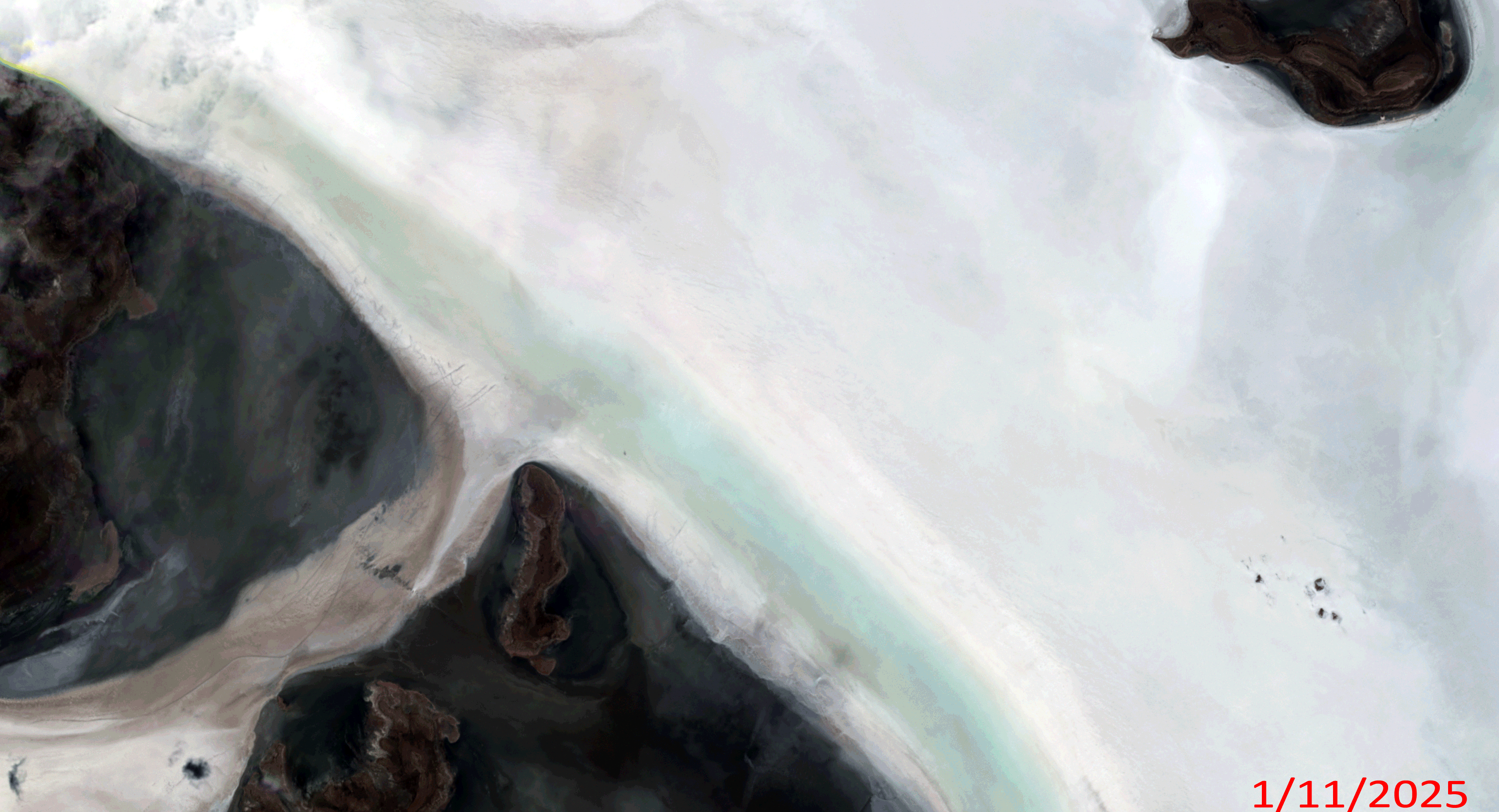 Click on the image above to see an animation of 3-meter natural color PlanetScope image collected over Salar de Uyuni in Bolivia on January 11, April 11, July 24, and December 24, 2025. In this animation, you can see just how much this memorizing landscape changes through the year. In the January image, you can see the start of the azure blue waters that will fill the valley in this location. By April, the blue waters have reached close to their maximum extent; and then in the July image the water is nearly all gone, only to be a barren landscape of white in the December 2025 image. (Images Courtesy: © Planet 2026)
PlanetScope is a constellation of more than 240 microsats referred to individually as Doves. Each Dove is able to collect up to 20,000 square kilometers (sq km) per day of 3-meter (m) 4-band multispectral (i.e. blue, green, red and near-infrared [NIR]) imagery; and newly launched SuperDoves collect 8-band multispectral adding in valuable red-edge spectral data. Across the constellation, PlanetScope is archiving more than 200 million sq km of medium-resolution imagery a day, making it the go to source for daily imagery over most locations. This massive archive dates back to 2016, offering the most complete and continuous record of spatial data on the planet since the start of the constellation’s ongoing launch schedule. Collecting 3-meter multispectral imagery is the equivalent of ‘high-resolution’ multispectral data imaged by a 75-centimer (cm) satellite (as this satellite would feature 75-cm panchromatic and 3-m multispectral), making PlanetScope an extremely competitively priced option at just $2.25 per sq km. With well registered images and nearly daily collections of most locations, PlanetScope is the ideal imagery source for this current-events focused series, Our Changing Landscape.
Bolivia’s Salar de Uyuni (The Salt Flats)
Described as “one of the most surreal landscapes on the planet,” Bolivia’s Salar de Uyuni poetically is where salt meets the sky and the horizon seems to stretch on forever. The salt flats – a huge tourist attraction – are heightened by cactus-speckled islands and bright pink flamingos that call the area home.
The Salar de Uyuni was formed as a result of transformations of seven Late Pleistocene lakes whose progressive desiccation led to the accumulation of extensive evaporitic salt deposits. The Salar de Uyuni, is the world’s largest salt flat stretching across 10,000 square kilometers, an otherworldly white desert formed from an ancient lake, creating surreal mirror effects during the rainy season (December through March) and hexagonal patterns in the dry season (May through November).
A thin layer of water transforms it into the world’s largest natural mirror, reflecting the sky perfectly during the rainy season. The salt crystallizes into unique, mesmerizing shapes during the dry season. April happens to be a key time to fully absorb the magic of the salt flats, because it converts into a visual mirror of the sky after rainfall. The reflection is breathtaking and unbelievable, tourists say.
Located high in the Andes, they’re a unique landscape for perspective photography, requiring guided 4×4 tours, usually starting from Uyuni, and visitors should prepare for high altitude and temperature swings. The Salar serves as the major transport route across the Bolivian Altiplano and is a prime breeding ground for several species of flamingos, which is another fun sight to see on trips.
The Salar has been used as a filming location for movies such as The Fall (2006), Salt and Fire (2016), The Unseen (2017), Star Wars: The Last Jedi (2017), and several others.
If you would like to find out more about using 3-meter PlanetScope imagery for your academic studies, engineering projects or any landscape analysis, let us know at sales@apollomapping.com or (303) 993-3863.

Leave a Reply