
In this monthly feature, we span the globe to examine Our Changing Landscape with a time series of medium-resolution PlanetScope satellite imagery. The PlanetScope constellation dates back to 2016 and collects hundreds of millions of square kilometers of four and eight-band 3-meter imagery daily! In February, we visited Kalamurina Wildlife Sanctuary in the Outback of Australia. For the March edition of this series, we check out the development of the High Roller Sand Mine in Texas of the United States.
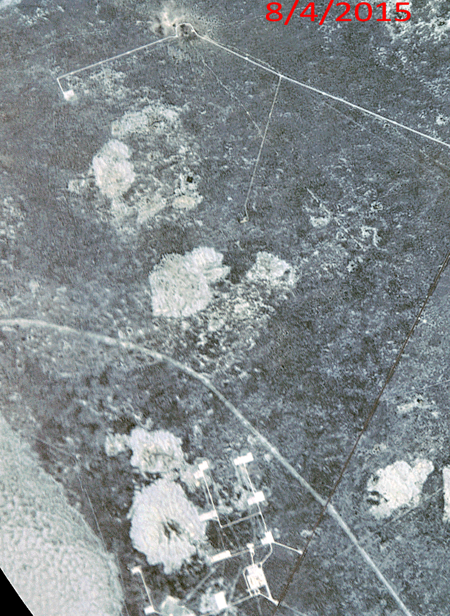
Click on the image above to see an animation of 3-meter natural color PlanetScope imagery collected over High Roller Sand Mine in Texas on August 4, 2015, June 25, 2019, June 19, 2023, and November 27, 2025. In this animation, you can see that the area is quite remote in the 2015 data with just a few well pads present. Over the years, the High Roller Sand Mine is established and grows rapidly as does a nearby mine site to the southwest. And it seems the sand mine is set to expand its footprint in 2026 as there is construction on a new extension to the mine on its southwest edge. (Images Courtesy: © Planet 2026)
The PlanetScope Microsat Constellation
PlanetScope is a constellation of more than 240 microsats referred to individually as Doves. Each Dove is able to collect up to 20,000 square kilometers (sq km) per day of 3-meter (m) 4-band multispectral (i.e. blue, green, red and near-infrared [NIR]) imagery; and newly launched SuperDoves collect 8-band multispectral adding in valuable red-edge spectral data. Across the constellation, PlanetScope is archiving more than 200 million sq km of medium-resolution imagery a day, making it the go to source for daily imagery over most locations. This massive archive dates back to 2016, offering the most complete and continuous record of spatial data on the planet since the start of the constellation’s ongoing launch schedule. Collecting 3-meter multispectral imagery is the equivalent of ‘high-resolution’ multispectral data imaged by a 75-centimer (cm) satellite (as this satellite would feature 75-cm panchromatic and 3-m multispectral), making PlanetScope an extremely competitively priced option at just $2.25 per sq km. With well registered images and nearly daily collections of most locations, PlanetScope is the ideal imagery source for this current-events focused series, Our Changing Landscape.
High Roller Sand Mine in Texas
High Roller Sand Mine is a state-of-the-art hydraulic fracturing sand facility in Kermit, Texas, which is located in the heart of the Delaware Basin. Iron Oak Energy bought High Roller Sand in April 2025 from the Higher Roller Group, describing its location as one of the highest-quality sand reserve deposits in the Permian Basin.
The Permian Basin accounts for more than half of the total proppant demand in the U.S. and continues to increase. The High Roller Sand facility produces up to four million tons of proppant annually for oil and gas operators throughout the region, specifically high-quality 40/70 and 100 Mesh natural sand proppants for oil and gas fracking.
The High Roller Sand Mine in Texas was strategically located near Kermit, Texas, in the Permian Basin, specifically around County Road 308, to serve oil and gas drilling operations sprawled across the Northern Delaware and Midland Basins.
Interestingly, when it was first established, the High Roller Sand Mine received the Texas Conservation Plan (TCP) Certificate of Inclusion. They were one of the only producers approved in the northern sections of the deposit and plan to continue to operate under a sand dunes sagebrush lizard (DSL) Conservation and Habitat Improvement Plan.
If you would like to find out more about using 3-meter PlanetScope imagery for your academic studies, engineering projects or any landscape analysis, let us know at sales@apollomapping.com or (303) 993-3863.

Leave a Reply