
Something special happens to your brain when you become a “GIS person.” You think differently. You see patterns where others don’t. You notice connections more quickly. It changed your brain. Eventually, it will probably touch most people. It becomes hard to not see the shapes and networks that emerge.
Often when I describe GIS to regular folks, people that haven’t met GIS yet, as points, lines, polygons, and images that are connected to a place with data about or associated with that place. Consider your city a dot on the map. There are many details about your city, and therefore we can associate all those details with the dot on the map that represents your town. Because of the data associated with that dot and all the other city dots, we can look at a map and ask questions. How many dots are within a state? How many of those dots have 20k people or less? How many were founded before 1900? You and that favorite mobile device are a point with many gigs of tracked information. Your dot has become a line or route. Your dot crosses into a geofence or polygon that prompts interactions at a store. To the regular person, they can begin to imagine a map of city dots with different sizes to represent the population data. They think about walking into the store. As GIS professionals you get it. Have you thought about how the notion of a point or the power of a point has changed over time?
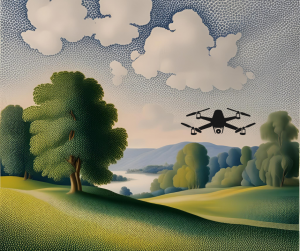 Image created in Canva – AI created background in Seurat style.
The power of the point could be aligned to art. Dots can be art. Pointillism began with Georges Seurat and Paul Signac in the late 1800s as they created collections of dots that formed an image like seen in “A Sunday on La Grande Jatte.” The fascination and creativity to give meaning and purpose to a dot as a collective artwork was cutting edge. Even if you’re not an art person, this should appeal to the modern GIS-er. Dots in mass become hotspots. Can you imagine if we processed Seurat’s painting as locations and ran hotspot analysis? Glowing people and animals would emerge.
Thanks to lidar and photogrammetry tools, points aren’t just cities or objects. Landscapes, anything really, can be measured and documented as a point cloud. I imagine that Seurat would have loved this concept. Dots become sculpture with the help of drones and other cool tools!
Now, “art” is 3D. We fly through landscapes, see details that are humanly impossible to reach or very unlikely and dangerous to capture by human hand. A recent Titanic digital twin was created and showcased in a National Geographic documentary, “amounting to 16 terabytes of data (equivalent to the hard drive footprint of six million e-books).” Researchers and subject matter experts dispelled myths associated with the Titanic. They helped prove personal accounts that had been dismissed to create an even more realistic interpretation of what happened April 15, 1912. Points changed history again.
The points of the cloud, the dots on the map, your destination, or the point you’re making in your presentation…all important. I’m reminded of the poem by Linda Ellis, “The Dash Between,” that shares the importance of the dash on a tombstone and what it really represents. The power of that dash is like the power in a point to tell a story, mark a moment, inspire a crowd, or right a wrong. Let’s continue to put our points to work and make a difference!
If you need me, I think that I will dust off my watercolor tools and get artsy to add some creativity to my dot.
Barbaree Duke
Geospatial Crusader

Interesting. It causes one to think of new vistas.