
In this monthly feature, we span the globe to examine Our Changing Landscape with a time series of medium-resolution PlanetScope satellite imagery. The PlanetScope constellation dates back to 2016 and collects hundreds of millions of square kilometers of four and eight-band 3-meter imagery daily! In December, we visited the Bay of Fundy in Canada. For the January edition of this series, we are looking at the September 2025 floods in Ayod, Sudan.
The PlanetScope Microsat Constellation
PlanetScope is a constellation of more than 240 microsats referred to individually as Doves. Each Dove is able to collect up to 20,000 square kilometers (sq km) per day of 3-meter (m) 4-band multispectral (i.e. blue, green, red and near-infrared [NIR]) imagery; and newly launched SuperDoves collect 8-band multispectral adding in valuable red-edge spectral data. Across the constellation, PlanetScope is archiving more than 200 million sq km of medium-resolution imagery a day, making it the go to source for daily imagery over most locations. This massive archive dates back to 2016, offering the most complete and continuous record of spatial data on the planet since the start of the constellation’s ongoing launch schedule. Collecting 3-meter multispectral imagery is the equivalent of ‘high-resolution’ multispectral data imaged by a 75-centimer (cm) satellite (as this satellite would feature 75-cm panchromatic and 3-m multispectral), making PlanetScope an extremely competitively priced option at just $2.25 per sq km. With well registered images and nearly daily collections of most locations, PlanetScope is the ideal imagery source for this current-events focused series, Our Changing Landscape.
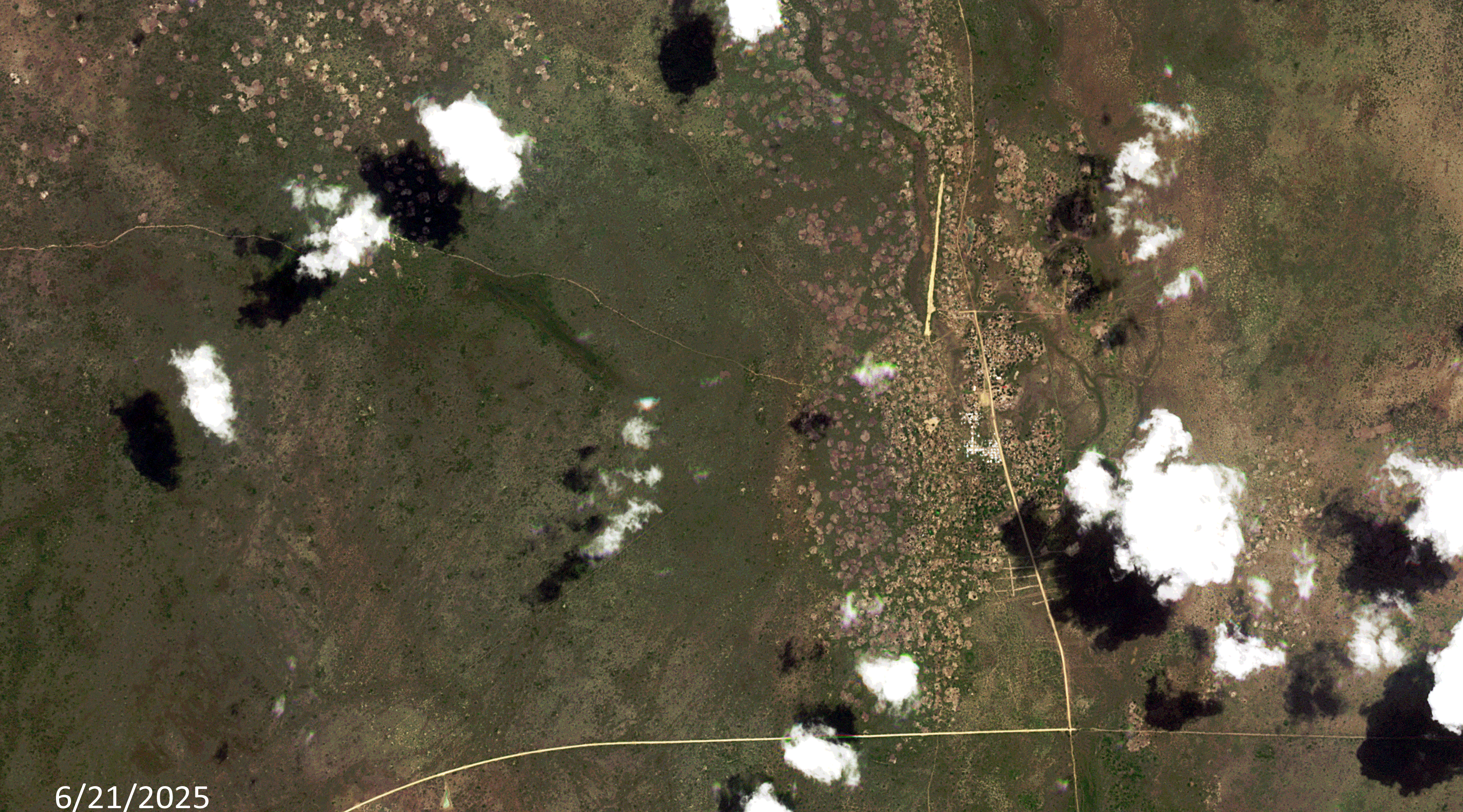 Click on the image above to see an animation of 3-meter natural color PlanetScope image collected over Ayod, Sudan on June 21 and September 18, 2025. In this animation, you can see how brown the landscape is and how low the rivers and canal that runs through the center are in June. Then in the September 18th image, you can see the rains have brought major flooding to the canal and Nile River tributaries in the central part of the image – further, the rains have revived lush, green plant life in the surrounding region. (Images Courtesy: © Planet 2026)
September 2025 Flooding Of Ayod, Sudan
The summer of 2025 started out with below average rainfall during the rainy season in the Blue Nile Basin. By early August, rainfall began to slowly increase, but experts who looked ahead anticipated a considerable increase in rainfall from late August through the end of September. Sudden flooding struck Sudanese states along the Nile basin in the second half of September, sparking a sharp rise in the water level of the Blue Nile – a tributary of the Nile River.
According to Atar, as part of a complex global ecological system, Sudan’s rainfall patterns are heavily influenced by the Indian Ocean, which drives seasonal monsoon winds toward the Ethiopian Highlands. The rainfall over the highlands largely depends on sea surface temperatures in the Indian Ocean, which trigger the Indian monsoon depression – a system that increases evaporation of moisture-laden air that moves northwestward. As this air mass reaches the highlands and cools, it condenses and results in rain.
This year, however, climate anomalies disrupted that pattern. The warming of the Indian Ocean, which typically begins in June, was delayed. Consequently, the rainy season in northern Ethiopia, particularly over the Tekezé Basin (Atbara River), also started late, well after June and July, leading to an eventual heavy surge in river flow.
Later, the Blue Nile Basin, which is the primary tributary feeding both the Grand Ethiopian Renaissance Dam (GERD) reservoir and the Blue Nile itself, saw intense rainfall from August through mid-September, followed by a gradual decline. These fluctuations can be described as natural climatic variability within the regional rain cycle. However, the GERD introduced a new variable into the dynamics of Nile flow. The natural flow of the river is no longer the sole determinant of water availability downstream in Sudan.
Instead of releasing a significant portion of the stored water from previous years in anticipation of new inflows during the 2025 rainy season, Ethiopia withheld large volumes. This was likely due to uncertainty about 2025 rainfall, especially after June and July experienced below-average precipitation, prompting fears that Ethiopia might lose part of its annual share if it allowed too much water to flow downstream to Sudan and Egypt, both of which insist on maintaining their historical annual quotas (18.5 billion cubic meters for Sudan, and 55.5 billion for Egypt, as per the 1959 Nile Waters Agreement).
In mid-September, just days after Ethiopia’s GERD inauguration festival on September 9th, residents of Blue Nile State in southeastern Sudan saw a rapid rise in river levels. The river soon overflowed into Ad-Damazin, Ar-Roseires, and other villages, prompting waves of emergency calls and social media images documenting the floods. Yet it was only a full week later, on September 22nd that Sudan’s Ministry of Irrigation and Water Resources issued its first official advisory on the rising water levels. Water levels continued to rise until September 29th.
On September 8th, severe flooding displaced about 50,000 people in Ayod County leaving many without food, shelter, or medical care, local officials said.
If you would like to find out more about using 3-meter PlanetScope imagery for your academic studies, engineering projects or any landscape analysis, let us know at sales@apollomapping.com or (303) 993-3863.

Leave a Reply