
Up to this point, users of high and medium resolution imagery products have had to use multiple search engines to discover and order that data that meets their project needs. Today, that changes with the launch of Apollo Mapping’s Image Hunter. Our imagery search engine is available 24 hours, 7 days a week and is a one-stop shop for every major source of medium and high resolution satellite imagery on the market today, including: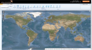
- WorldView-2
- QuickBird
- WorldView-1
- GeoEye-1
- IKONOS
- Pléiades 1A (coming soon)
- The SPOT constellation (coming soon)
If any of our readers have struggled with other geospatial search engines, Image Hunter features:
- Near-instantaneous loading of low resolution preview imagery with associated collection date and key metadata
- Ability to define your area of interest by address and with coordinates, geometric shape or shapefile/KMZ
- Responsive base layer with street names and imagery to provide a spatial context when discovering data
- Online ordering of satellite imagery from 3 data providers and 7 constellations
- Global coverage with tools to measure distance and create annotated maps
Image Hunter can be accessed here. If you would like a Quick Start Guide to get up and running, it can be downloaded here. We are excited to find out what you think about Image Hunter and any ideas you might have to improve the user experience – we can be reached anytime at (303) 993-3863 or at sales@apollomapping.com with these suggestions.

Leave a Reply