
Astrium and the Agence Française de Développement (AFD) are launching the first satellite imagery portal aimed at protecting the forests of Africa
- More than 600 satellite images are now available to help monitor changes in forest cover in Central Africa
- By developing space technologies to monitor the effectiveness of strategies for reducing greenhouse gas emissions, Astrium is helping to fight climate change
Paris, 26 October 2011 – Astrium Services, via its GEO-Information business, and the Agence Française de Développement (AFD) have launched a portal to provide satellite imagery of the forests in the Congo Basin to organizations working to conserve the region’s forests. Over 600 SPOT satellite images will now be directly accessible via this portal.
By comparing archive imagery against new images, it will now be possible to track changes in the Congo Basin’s forest cover. Administrations, public institutions and NGOs working on sustainable forest governance in the region will use the images and the accompanying value-added services to more effectively monitor land use – a key to sustainable management of the forests in Central Africa. The data is also crucial for measuring the effectiveness of national strategies and defining plans of action as part of the REDD+ program (Reducing Emissions from Deforestation and forest Degradation).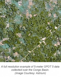
SPOT satellite images of the Congo Basin will be made available to all organizations working on forest preservation projects that specifically focus on reducing emissions resulting from deforestation or forest degradation, preserving or increasing forest carbon storage, or promoting sustainable forest governance.
Financing for the free portal is being provided by Astrium and by the AFD as part of a broad initiative to protect the forests of the Congo Basin using space technologies. The project is being overseen by a consortium of partners including IGN France International (IGN-FI), the Centre National d’Etudes Spatiales (CNES), the Institut Géographique National (IGN), the Institut de Recherche pour le Développement (IRD) and the international branch of the Office National des Forêts (ONFi).
The space imaging portal for the Congo Basin forests was today officially opened in Paris at the REDD+ workshop, which brings together economists, scientists, forest management organizations, specialists and technology providers working to preserve tropical forests. The event is organized by Planet Action, Astrium’s corporate social responsibility (CSR) initiative that is helping to fight climate change through the donation of geo-information technologies.
The satellite imagery portal for the forests of the Congo Basin is available at http://bassinducongo.reddspot.org/. Additional information is also available on the GEO-Information website of Astrium Services: www.astrium-geo.com.
For more information about the Astrium constellation of satellites, contact an Apollo representative by phone at (720) 470-7988 or by email at brock@apollomapping.com.

Leave a Reply