

In this monthly feature, we span the globe to examine Our Changing Landscape with a time series of medium-resolution PlanetScope satellite imagery. The PlanetScope constellation dates back to 2016 and collects hundreds of millions of square kilometers of four and eight-band 3-meter imagery daily! In September, we were at Gressan, Italy, and the popular Giro d’Itaia. For the October edition of this series, we are looking at the beautiful and very remote island of Tristan da Cunha.
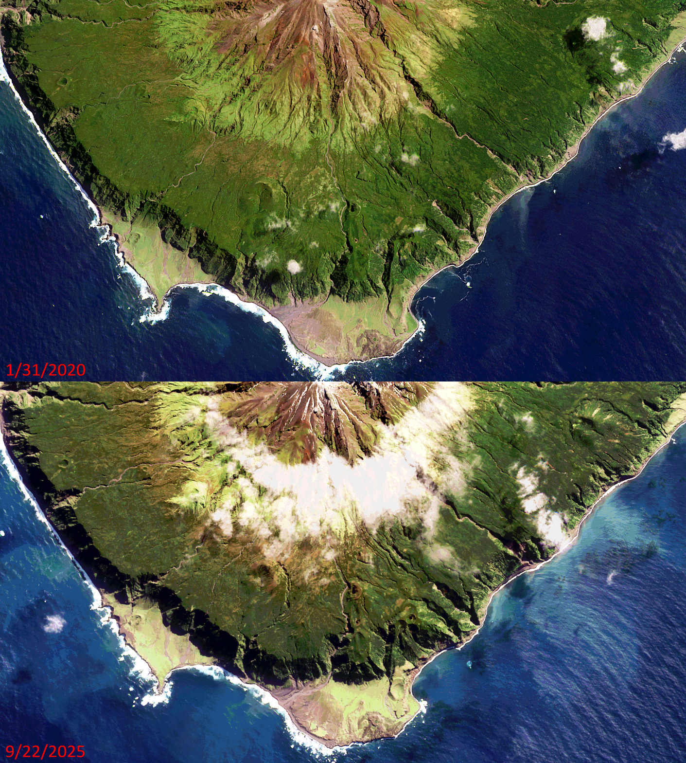 Click on the image above to see an animation of 3-meter natural color PlanetScope image collected over Tristan da Cunha on January 31, 2020 and September 22, 2025. In this animation, well to be upfront there is not much to see! Which is refreshing and quite unusual in this rapidly changing world of ours. Being one of the most remote locations on the planet has a way of doing that to a landscape – enjoy the views of this pristine volcanic island covered in lush, mostly untouched forests. (Images Courtesy: © Planet 2026)
Do you enjoy the high-resolution satellite imagery we post monthly in this article and elsewhere in The Geospatial Times? If so, head over to our Reddit subgroup, HighResSatelliteImage, where we post some our favorite high-resolution satellite images on a weekly basis.
The PlanetScope Microsat Constellation
PlanetScope is a constellation of more than 240 microsats referred to individually as Doves. Each Dove is able to collect up to 20,000 square kilometers (sq km) per day of 3-meter (m) 4-band multispectral (i.e. blue, green, red and near-infrared [NIR]) imagery; and newly launched SuperDoves collect 8-band multispectral adding in valuable red-edge spectral data. Across the constellation, PlanetScope is archiving more than 200 million sq km of medium-resolution imagery a day, making it the go to source for daily imagery over most locations. This massive archive dates back to 2016, offering the most complete and continuous record of spatial data on the planet since the start of the constellation’s ongoing launch schedule. Collecting 3-meter multispectral imagery is the equivalent of ‘high-resolution’ multispectral data imaged by a 75-centimer (cm) satellite (as this satellite would feature 75-cm panchromatic and 3-m multispectral), making PlanetScope an extremely competitively priced option at just $2.25 per sq km. With well registered images and nearly daily collections of most locations, PlanetScope is the ideal imagery source for this current-events focused series, Our Changing Landscape.
Tristan da Cunha
Tristan is an active volcanic island with rare wildlife and happens to be home to 222 British Citizens living in the world’s most isolated settlement of Edinburgh of the Seven Seas. The territory consists of the inhabited island Tristan da Cunha, which has a diameter of roughly 11 kilometers (6.8 miles) and an area of 98 square kilometers (38 sq miles); the wildlife reserves of Gough Island and Inaccessible Island; and the smaller, uninhabited Nightingale Islands.
Tristan da Cunha is a British Overseas Territory – one of the remaining former colonies that has not yet asked for independence and wants to remain linked to the United Kingdom. For Tristan, the connection dates back to 1816 when the island was garrisoned by Britain. Tristan da Cunha’s economy is based on traditional subsistence farming and fishing to provide islanders with their own food. Valuable foreign earnings come from the royalties off commercial crawfishing (or Tristan Rock Lobster) and the sale of postage stamps and coins, especially to philatelists and collectors worldwide.
Anyone wanting to visit Tristan da Cunha will have to plan ahead. All visitors need the prior approval of the administrator/Island Council, and should be prepared, upon request, to obtain a local police certificate in advance for your arrival on the island. On July 7, 2026, the island was hit by a severe storm that caused some damage and limited visitors. In fact, high winds in the storm grew to hurricane-force winds with gusts exceeding 100 mph.
If you would like to find out more about using 3-meter PlanetScope imagery for your academic studies, engineering projects or any landscape analysis, let us know at sales@apollomapping.com or (303) 993-3863.


 Copyright © 2025 All Rights Reserved -
Leave a Reply