
Price Changes to Advanced Elevation Series DEMs
An animated comparison of 2-meter AES elevation models created over Dunedin, New Zealand; the first image is a DSM and the second is a…

Featured article
In this monthly article, we travel the world to check out unique, fun and sometimes a bit weird 30-centimeter (cm) color imagery samples from the WorldView constellation. In September, we looked at…

An animated comparison of 2-meter AES elevation models created over Dunedin, New Zealand; the first image is a DSM and the second is a…

Some how I’ve avoided jury duty my whole life. I’ve moved around a lot, so that might have something to do with it–the powers-that-be…
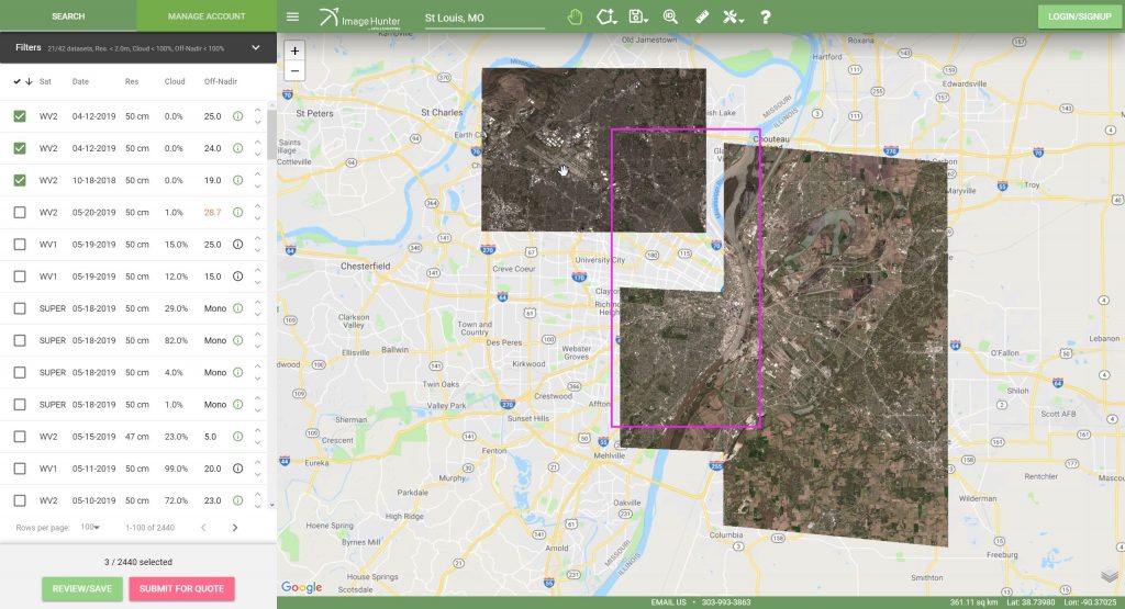
If you are searching for medium and high-resolution satellite imagery, the search is over as Image Hunter is the solution you’ve been looking for!…

Are you assessing land use cover over a large region? Perhaps you are looking to improve the results of your automated classifications? Or maybe…
Life! We are all very curious about where we come from and how we got here. It’s a well-established theory that the components for…

When high off-nadir imagery works out, it is some of the coolest data we have; but when it doesn’t work out it is a…
Find the imagery you need, your way.
From area of interest to delivered assets — typically within 24 hours.

Self-serve
Define your area of interest, compare results, and request pricing
— all in minutes.
Best for experienced users who know what they need.

Done for you
Share your area, timeframe, and goals
— we’ll handle the rest.
Ideal if you’re unsure which imagery is right for your project.