
From Colorado, we travel west to the great state of California with a stop at the Silverado Resort and Spa in Napa, site of the US PGA Tour Fall Series event, the Frys.com Open. The eighth Frys.com Open will be held from October 6th to the 12th and played on the North Course. The winner of the event walks away with $900,000 from the $6 million purse as well as 500 FedEx Cup points. In addition, the winners of all Fall Series tournaments will be given automatic entry into next year’s PGA Championship, but not to the Master’s. Since its inception, the Frys.com Open has generated more than $6 million for local charities, including the American Institute of Mathematics, and more than $1 million alone in each of the last two years.
 A 50-cm color image of Silverado Resort and Spa collected on June 30, 2014 by Pléiades 1B. To see this course in 1.5-meter resolution, check out this month’s feature on SPOTMaps. Image photo enhanced by Apollo Mapping. © CNES 2012, Distribution Airbus Defense and Space / Spot Image S.A., France, all rights reserved.
The two golf courses, North and South, at the Silverado Resort and Spa were designed by Robert Trent Jones and built in 1966. In 2011, a significant renovation of the North Course was completed by Johnny Miller, which included adding more than 300 yards to the links, new grasses, tree and bunker removals and fairway realignments. The two courses at Silverado cover more than 360 acres of rolling, lush hills covered with oak, pine and redwood trees that are one hundred years and older as well as multiple water hazards. During its near 50 year existence, the Silverado Resort and Spa has hosted 28 tournaments on the PGA and Champions Tour. Playing 7,226 yards long at par 72 for tournaments, the shortest hole on the North Course is the par 3 11th Hole at 183 yards; and the longest are the par 5 16th and 18th Holes each playing 574 yards.
Given that the Frys.com Open is a Fall Series tournament, it does not draw the same star studded field that the regular season PGA events do. That said, 144 players enter the open each year, and well, their level of play is just a bit more advanced than my own snowman styles are, haha! Last year’s event was won by Jimmy Walker with a score of 17 under, two strokes ahead of second place finisher, Vijay Singh.
The Pléiades 1 High-Resolution Satellite Constellation
The Pléiades 1 constellation (or at least part of it!) has been in orbit since December 2011 and if you have not had a chance to check out any sample imagery, take a few moments and have a look at the gallery on our website. If you work with high resolution imagery, you should consider Pléiades 1 for your next geospatial project.
A variety of Pléiades 1 products are available from both a growing archive and as a new collection, including 50-centimeter (cm) pansharpened imagery and 50-cm panchromatic–2-meter (m) 4-band multispectral bundles. We are happy to discuss the technical specifications, pricing and tasking options available with this satellite constellation.
Working with Pléiades 1 since the launch of the first twin satellite, P1A, we have noticed that:
- Airbus Defense and Space is able to deliver on their tasking feasibilities.
The Apollo Mapping sales team can answer any questions you might have about the high resolution satellite constellation, Pléiades 1. We can be reached anytime at (303) 993-3863 or sales@apollomapping.com.
More sample images and technical information about Pléiades 1A and 1B can be found on our website here.

 This map shows the areas imaged by WorldView-2 from January 1 to March 31, 2014 over Brazil. Please note that in many instances, multiple images were collected over the same area which is difficult to portray on this static map.
In this monthly piece, we give our readers a sense of the high-resolution imagery coverage collected over a geography during a specified window. To do this, we pick a high resolution satellite, a defined time period and area of interest, then report key statistics on the total amount of imagery collected in square kilometers (sq km). Without further delay, let’s jump into our analysis.
Graphic Region of Interest: Brazil
Land Mass Covered: 8,473,085.3 sq km
Time Period: January 1 to March 31, 2014
High Resolution Satellite: WorldView-2
WorldView-2 Imaging Statistics–Brazil
Total Area Collected: 2,634,715.0 sq km
Area Collected @ 20% or Less Clouds & 30 Degrees Off-Nadir: 554,605.7 sq km; 6,162.3 sq km per day; 21.05% of total
 A chart showing the times of the year (with respect to latitude) that nighttime imaging is possible with EROS B.

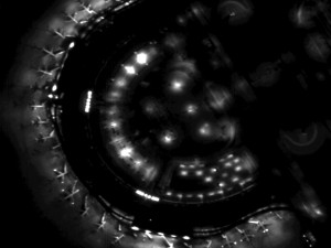 Previews of ~70-cm EROS B imagery collected during the night over Dallas-Fort Worth Airport on September 14, 2008. (Images Courtesy: ImageSat International)
Do you need high-resolution satellite imagery collected at nighttime over nearly any location on the planet?
If so, Apollo Mapping has a solution for you! Partnering with ImageSat International, the owner and operator of the satellites EROS A and EROS B, we are able to provide you with custom nighttime collections of ~70-cm panchromatic imagery over areas as small as 50 square kilometers. As an added bonus, the price for this nighttime imagery is still below what you would pay for the minimum collection of color, high-resolution, daytime imagery.
We have tasked EROS B on multiple occasions and have been impressed with the turnaround time and high-quality panchromatic imagery it can deliver. While many people shy away from black and white only data, when it comes to nighttime imagery, there is little to no difference between black and white and color data. Further, by collecting only panchromatic data, EROS B can maximize collection capacity so you receive tasked imagery quicker.
Key Specifications of EROS B
- Launch Date – April 25, 2006
- Spectral Bands – panchromatic only
- Resolution – 70 centimeter (varies with orbital height, off-nadir angle and imaging mode)
- Revisit Time–~3.5 days (varies with latitude and off-nadir angle)
- Swath Width – 7 km (varies with orbital height and off-nadir angle)
- Bit Depth – 10-bits
- Orbit Height – 520 km (varies about this average)
For more information on this new nighttime, high-resolution tasking service, please visit our website or contact the Apollo Mapping sales team at (303) 993-3863 or sales@apollomapping.com.
“Everyone Poops” is the title of an internationally famous children’s book first published in Japan in the late 1970s. It wasn’t until 1993 that it appeared in English, long after I had realized the truth of that simple statement. What could have been had I had access to that work of art in my earliest formative years…
So, we all agree, everyone poops. But what do we do with that poop? Well, for us humans, we let the inner workings and hidden mechanisms of our toilets and bidets do the magic work, and from there it goes to a sewage treatment plant. Then we repeat. Every day, for the rest of our lives. And we don’t even get paid for it!
But just as the title implies, animals poop too, including our precious little critters that capture our hearts and sleep on our beds. But they don’t have the benefit of toilets and treatment plants; no, they have the benefit of their “owners” following them around with bags and scoops, picking up their droppings. Then we carry them to the nearest garbage can where the poo in question is then trucked off to a landfill with our losing lottery tickets, skinny jeans and empty Doritos bags. Depending on the type of landfill, the garbage gods either bury our junk or infuse it with water to start a process of decomposition that lasts years, if not centuries. And we keep offering more junk with no reward, poo included.
But as our world has become more environmentally conscious over the years, we’ve stopped wearing skinny jeans (hopefully) and been more respectful about separating our trash, recycling more and compositing our green waste. But that dreaded dog poo still goes in the trash. Until now, maybe!
 All dogs go to heaven, as the movie title indicated, but before they do, they should stop here at Elk Meadow dog park in Evergreen, Colorado. At 107 acres, it is the biggest dark park in the state. All that space doesn’t mean it is okay to leave your poo behind though; pack it out! 60-cm color image was captured by QuickBird on August 12, 2012, and comes courtesy of DigitalGlobe. Photo enhanced by Apollo Mapping.
Apollo Mapping’s hometown of Boulder, Colorado is a dog’s paradise. Unlimited access to trails, high-end shops catering to our pooches needs that rivals anything the Kardashians may need in their daily lives and plenty of loving, wagging tails to go around. People are pretty conscious about their respect of others when it comes to de-pooing trails, but now the city is taking the next step: composting dog waste. The city has recently set aside $10,000 for the trial program which will feature compostable bags at three popular trailheads. A current estimate of dog waste removal in the city’s open space parks is at 25-30 tons a year! Holy shit! That’s a lot of poo!
Letting poo go to the landfill leads to the production of methane and could lead to negative ramifications including excess greenhouse gas and depletion of our already ailing ozone layer. By composting the unwanted and unsightly poo, the “output” can return to the earth as a valuable resource for growing vegetation. However, you don’t want to use it on edible plants unless you can confirm the waste comes from a vegetarian dog; omnivorous dogs’ waste can contain bacteria that are harmful to humans if ingested. So, while the final resting spot of our beloved pets’ waste is still in development, there is hope that a better use can come of it. So happy pooing, pups!
Justin Harmon
Staff Writer
Many of our readers have likely not heard of KOMPSAT-3. If you are one of them, we suggest you think about it for your next project requiring high resolution satellite imagery. And in particular, for those of you who work with vegetation and/or spectral analysis as KOMPSAT-3 is the only multispectral high resolution satellite in the world to collect data in the afternoon. Further, KOMPSAT-3 has the highest data quantization of any satellite on the market.
If you are not familiar with KOMPSAT-3, here is a summary of the key satellite specifications:
 A 70-cm natural color sample image collected by KOMPSAT-3 on May 19, 2013 over Miami, Florida. Sometimes imagery can be a teaching lesson as is the case here. In the imagery sample, you will see some areas with very bright yellow and white spots, these are called flares. Flares are imagery aberrations that cannot be correct and are caused by reflections off very bright surfaces like roofs and water. This data has been photo enhanced by Apollo Mapping. Additional samples of color 70-cm KOMPSAT-3 imagery can be found here.
- Launch Date: May 17, 2012, 16:39 UTC
- Spectral Bands:
- Panchromatic
- 4-band multispectral (blue, green, red and NIR)
- Sensor Resolution:
- At nadir–70-cm panchromatic & 2.8-m multispectral
- 20° off-nadir–82-cm panchromatic & 3.28-m multispectral
- 30° off-nadir–1.02-m panchromatic & 4.08-m multispectral
- 45° off-nadir–2.11-m panchromatic & 8.44-m multispectral
- Dynamic Range: 14-bits
- Revisit Frequency: (at 40°N)
- 1.4 days (< 45° off-nadir)
- 4.1 days (< 20° off-nadir)
- Mean Local Crossing Time: 13:30 local time (approximate; across lit side of Earth)
- Footprint Width: 16 km (at nadir)
- Maximum Collection Geometry:
- Mono, strip mode–16 km x 4,000 km (1 strip wide)
- Mono, wide area mode–48 km x 100 km (3 strips wide)
- Stereo, single pass mode–16 km x 200 km (2 pairs wide)
- Daily Collection Capacity: 300,000 sq km
- Georeferenced Horizontal Accuracy: 48.5-m CE90 (global average, dependent on terrain)
Having worked with sample images for the past several weeks, we are impressed with the crispness of KOMPSAT-3 data and its color reproduction. We feel that KOMPSAT-3 separates itself from other high-resolution satellites in two key ways:
(1) 14-bit depth which is important for spectral analysis. With 14-bit depth data, KOMPSAT-3 has a maximum digital number (or pixel value) range of 16,384 units. Compared with the maximum digital number range of 4,096 for Pléiades 1 and then 2,048 for the other high-resolution satellites in orbit now, this is a significant advantage for you remote-sensing academics and professionals out there.
(2) A 1:30 PM local collection time. All other multispectral high-resolution satellites collect imagery during the mid-morning, so an afternoon collection time can be an advantage in persistently cloudy areas like tropical islands. This is also an advantage for vegetation analysis as chlorophyll concentrations change though out the day; so coupling KOMPSAT-3 with imagery collected during the morning, can give researchers a more complete picture of plant health.
If you are interested in pricing, coverage and/or have any additional questions about KOMPSAT-3 data, please let the Apollo Mapping sales team at sales@apollomapping.com or (303) 993-3863.
For those of you in need of ready-to-use, wide-area coverage mosaics, 5-meter natural color RapidEye Mosaics are a perfect fit. RapidEye Mosaics are virtually cloud-free and have been created with recent imagery collected during narrow time frames. With a 77-km wide footprint and five identical satellites in orbit, there is no better constellation to image huge areas in short times than RapidEye. These wide-area mosaics are competitively priced so ask your Apollo Mapping representative for a quote to support your next mapping project.
August 2014 Coverage Update
 A map of the off-the-shelf 5-meter RapidEye Mosaics (in green) that are available. Custom mosaics are available upon request.
- These country land masses were added to the RapidEye mosaic database this month:
- India (parts of the country, there are now 22 Indian states in the database)
Here is a summary of the key features and product specifications for RapidEye Mosaics:
RapidEye Mosaic Features
- Priced at less than $1.50 per square kilometer with a 500 sq km minimum order size
- Recent and virtually cloud free imagery (no more than 3%) collected in the most narrow time frame possible
- GIS-ready format
- Quick delivery as they are off-the-shelf mosaics
- Custom mosaics available if they are not offered now
RapidEye Mosaic Specifications
- Image Bands: True natural color mosaics created from raw red, green and blue spectral bands
- Resolution: 5-meters
- File Format: GeoTIFF with associated metadata files
- Bit Depth: 8-bit color balanced
- Projection/Datum: UTM WGS84
For more information about RapidEye Mosaics, you can reach an Apollo Mapping representative at (303) 993-3863 or at sales@apollomappping.com.
Heading northwest from Monterrey, Mexico, we skip over the border and into a state that used to be part of Mexico, Texas. San Antonio is the next stop on our tour of this Small World, and it is a city full of cultural richness and history. The city may be best known for two attractions: The Alamo Mission and the River Walk.
 The 1938 “San Antonio River Beautification Project” was as forward-thinking as it gets when it comes to planning for tourism and adding character to a city. Even though it was born of pragmatic origins, the end result was an resounding success for the city. This 60-cm color image was captured by QuickBird on July 10, 2013, and comes courtesy of DigitalGlobe. Photo enhanced by Apollo Mapping.
The Alamo is a former Roman Catholic mission and the site of the 1836 Battle of the Alamo. Lasting less than two weeks, the Battle was pivotal in the Texas Revolution, or War of Independence. Starting in October of 1835, the Revolution pitted the Mexican government against the Texas colonists, and led to the establishment of the Republic of Texas. Mexico had encouraged settlers to move into the territory known as Texas to form militias that would provide protection from the indigenous Indians of the area; but slowly, many of the inhabitants actually came from the United States, and so Mexico attempted to take back power over the land from the encroachers. Well, this article isn’t meant to be a history lesson, but long story short, the Lone Star State and its famous flag soon flew over the former Mexican territory.
Back to the Alamo, how easily I get sidetracked. The Alamo was built in the late 18th Century by the Spanish Empire for the education of native people and their eventual conversion to Christianity. It ultimately fell out of use and was taken over by the Mexican army. Then the Alamo was surrendered to the Texan army in 1835 and held by a small number of fighters. In February of 1836, Mexican General de Santa Anna overtook the defenders and destroyed much of the edifice. Attempts to rehabilitate the ailing but historically relevant structure started in 1892. Today, it is one of the key landmarks in San Antonio, welcoming more than 4 million visitors per year.
 The Tower of the Americas was built a year before the Space Needle, and perhaps acts as a reminder that Texas stands alone as the Lone Star State. It once stood as the tallest observation tower in the United States. 60-cm color image was captured by QuickBird on July 10, 2013, and comes courtesy of DigitalGlobe. Photo enhanced by Apollo Mapping.
The River Walk is the other hot spot for tourists to flock to when they come to San Antonio. Technically, it is a network of walking and boating paths along the banks of the San Antonio River, but its origin resides in the response to a horrendous flood in the early 1920s. The River Walk was originally designed as a flood bypass to divert excess water, but it serves a much more scenic use as well. At its inception, the River Walk was about 2.5 miles long, but popularity of the attraction and the desire for businesses to use it as a backdrop forced its expansion. In 2011, it was extended with an addition called the Mission Reach which was also an environmental restoration project along the San Antonio River.
San Antonio is also known for its many cultural events and attractions, such as museums, parks, theaters and zoos. The popular ‘San Antonio Stories’ film series focuses on the “international crossroads” that mark the city as a popular melting pot of global culture. The series adds to the breadth and depth of San Antonio’s reputation as an artistic hub, and features films on the oddities of its culture. For example, a local bike shop that promotes a FrankenBike swap meet, a photographer that turned his hobby of photographing bands into a dynamic career and the ever-popular Dignowity Hill Pushcart Derby. All of these films and many more showcase the uniqueness and charm of San Antonio. Go ahead and check it out for yourself!
Justin Harmon
Staff Writer