
For projects requiring a more detailed look than can be offered by the common free sources of elevation data and for those in cloudy or hard-to-reach regions where this data is of poor quality, Astrium GEO’s Elevation10 product suite is the ideal solution. Elevation10 is a 10-meter digital elevation model (DEM) derived from stereo pairs collected by the radar satellite, TerraSAR-X. These DEMs are often delivered within a month from order placement utilizing data obtained in the past two years.
TerraSAR-X is a synthetic aperture radar (SAR) satellite, meaning it is an active sensor unlike the optical satellites most of us are familiar with such as QuickBird, Pleiades 1 and WorldView-2. An active sensor is one that (1) creates an energy pulse, in this case radar waves; (2) aims them at a surface, in this case our planet; and then (3) very accurately measures the amount of time it takes for this pulse to return to the sensor. Radar waves can pass right through clouds which are an optical satellite’s worst nightmare.
As TerraSAR-X is measuring the time it takes energy pulses to return to its sensors as well as its position in space in the XYZ directions, radar stereo pairs have higher accuracy than do traditional pairs collected by optical satellites. This means that elevation data extracted from TerraSAR-X stereo pairs is accurate even without the use of ground control points. Ground control points can be expensive to collect–particularly in remote and unsafe areas–so this can be a significant cost savings vis-à-vis other elevation products.
Elevation10 is created from TerraSAR-X radar stereo pairs collected in StripMap mode. StripMap data has resolution up to 3-meters with a footprint that is 30 kilometers (km) wide by 50 km long. By employing TerraSAR-X stereo pairs collected in both ascending and descending directions, Astrium GEO is able to remove many of the anomalies that are common in SAR elevation data.
Elevation10 is offered as both a digital surface model (DSM) which includes vegetation, buildings and other human-made structures; and as a digital terrain model (DTM) where these have been removed. DTMs are hydrographically enforced to make sure that features which impact water flow, such as dams and embankments, are represented. Hydrographic enforcement is also offered with DSMs. The accuracy specifications for Elevation10 are as follows:
- Absolute Horizontal Accuracy–5 to 10 meters (Circular Error 90%, CE90)
- Absolute Vertical Accuracy–5 to 10 meters (Linear Error 90%, LE90)
For regions of the world with limited access, such as the Himalayas and the Andes, or in regions with persistent cloud cover and/or haze, such as Malaysia and Beijing, Elevation10 is the ideal solution. Elevation10 data is priced by the square kilometer according to area and product type with academic discounts available. For more information about Elevation10, contact your Apollo Mapping sales representative at (303) 993-3863 or sales@apollomapping.com.
Many of our readers may have seen the recent string of news articles about the shrinking extent of Arctic Sea ice, but perhaps you have never analyzed the data for yourself. If that is the case, the US National Snow and Ice Data Center (NSIDC) has made a variety of data layers available that can be viewed with Google Earth on glaciers, snow, ice shelves and more. You can find the collection here.
The NSIDC Google Earth overlays are derived from multiple government satellites such as ASTER and MODIS as well as more than 10,000 photographs of glaciers dating back to the 1880s. The layers are downloaded in KMZ format and with a double-click, they open in Google Earth (assuming you have this freeware software installed). Once the layers are open, a new interface is added to the top left of Google Earth which lets you move forward and backward in time through the images. Clicking on the small clock icon with a play button will move you through the animation automatically. If you click on the settings icon (the wrench at the top right of the toolbar), then you can change the animation speed among a few other settings.
The September Sea Ice Extent file is definitely an eye-opener to the changes that are happening right now to our fragile arctic ecosystem.
Until my next edition of Free For All, happy hunting for free GIS data!
Brock Adam McCarty
Map Wizard
(720) 470-7988
brock@apollomapping.com


A series of 1.5-meter natural color SPOT 6 imagery collected on November 2, 2012 over Toulouse, France. These images were photo enhanced by Apollo Mapping. © CNES 2012, Distribution Astrium Services / Spot Image S.A., France, all rights reserved.
The Apollo Mapping sales team is happy to announce that starting immediately, we are accepting orders for Astrium’s newest medium resolution satellite, SPOT 6. SPOT 6 offers 1.5-meter panchromatic and 6-meter multispectral resolution products with a 60-kilometer (km) wide footprint. Offering a blue band for the first time, SPOT 6 can collect 3 million sq km per day–making it the choice for regional and country-wide mapping projects as well as agricultural monitoring. Later this year, SPOT 6 will be joined by its twin in space, SPOT 7, doubling imagery collection capacity and offering daily revisits.
Key Satellite Specifications Of SPOT 6
- Spectral Bands: panchromatic, 4-band multispectral (blue, green, red and near-infrared)
- Product Resolution: 1.5-m panchromatic, 6-m multispectral
- Average Revisit Time: at most 1 day (once SPOT 7 is operational)
- Footprint Width: 60 km (at nadir)
- Orbital Height: 694 km (at equator)
- Launch Date: September 9, 2012
For more information about SPOT 6 and 7, please contact the Apollo Mapping sales team at sales@apollomapping.com or (303) 993-3863.
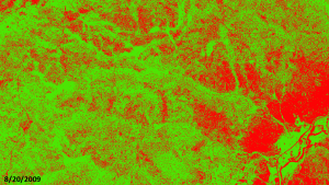
In this monthly feature, we span the globe to examine Our Changing Landscape with time series of medium resolution RapidEye satellite imagery. The RapidEye archive dates back to late 2008 and already contains more than 3 billion square kilometers of data. This month, we look at an issue that we know rather personally with our Boulder, Colorado office–the Mountain Pine Bark Beetle (MPB) outbreak.
The RapidEye Constellation
RapidEye is a constellation of five 5-meter medium resolution satellites each offering five spectral bands of information. The RapidEye constellation offers a daily revisit time to every location on the planet with a huge footprint that is 77-km wide. The data is priced competitively with a base price of $1.28 per square kilometer for all five spectral bands–academics do receive discounts. RapidEye adds a fifth band, the red edge, to the ‘traditional’ multispectral set of blue, green, red and near-infrared (NIR). The additional spectral data available in the red edge band allows users to extract more useful land ‘information’ than can be from traditional 4-band imagery sources. When RapidEye imagery is ordered as a Level 3A Orthorectified product, images from multiple dates are extremely well registered, making it the ideal data source for Our Changing Landscape.
The Mountain Pine Bark Beetle Outbreak
Mountain pine beetle, Dendroctonus ponderosae, is a native to the forests of western North America and periodic outbreaks mark the ecological record of the region. During an outbreak, MPB target ponderosa, lodgepole, Scotch and limber pine, starting with older, stressed and injured individuals and then spreading to all trees once the epidemic is full-blown. It is also not uncommon for related beetles to target other pine species in the dying forest. 8 to 10 months after a tree is infected, its foliage turns yellow to reddish as it succumbs to MPB. In the cold winter months, MPB larvae breakdown glycerol to protect from freezing.
The current MPB outbreak is the worst on record with more than 41.7 million acres infected across the western United Stated and Canada since it started in 1997. This outbreak appears to be exacerbated by the convergence of environmental and social pressures. Since the start of the 2000s, there has been an extended drought across much of western North America which many link to Global Climate Change–regardless of the cause of the drought, trees in droughty conditions are more stressed and this makes them more susceptible to a MPB infection. Further, the winters have been warmer so larvae which may have succumbed to extended periods of cold weather survived. These environmental stresses are conflated by commonly employed forest management techniques in the West which reduce the occurrence of natural fires (often important to maintaining healthy forest stand dynamics) and thus encourage denser forest stands. Denser forest are prime targets for a rapidly-spreading MPB outbreak.
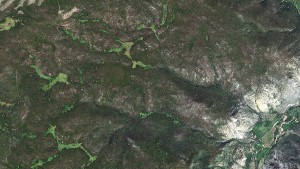
A natural color look at our area of interest in Roosevelt National Forest, Colorado. This 5-meter RapidEye image was collected 8/20/2009.
The Front Range of Colorado and southern Wyoming have been particularly hard hit by the MPB outbreak. Since 1996, the United States Forest Service estimates that 6.6 million acres in Colorado and 3.65 million acres in Wyoming have been impacted. In this edition of Our Changing Landscape, we look at a the spread of MPB in a rural section of the Roosevelt National Forest–a secluded Colorado forest stand along the Front Range of the Rocky Mountains.
If you would like to find out more about using RapidEye for your academic studies, engineering projects or any landscape analysis, let us know at sales@apollomapping.com or (303) 993-3863.
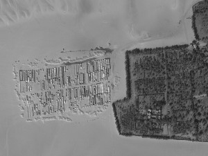
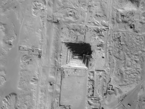

A series of 68-cm panchromatic EROS B images collected outside Saqqarah, Egypt on February 23, 2013. (Image Source: ImageSat International)
Do you need high resolution imagery now?! And at a price that will not break the bank?
If so, you need to consider EROS B for your next geospatial project. With the lowest minimum order price for a new collection of high resolution satellite imagery, EROS B is a viable solution for those in need of rapid tasking. The tasked imagery is budget friendly with a guaranteed collection within 7 days of order confirmation anywhere on the planet!
EROS B delivers panchromatic-only imagery to assure maximum tasking capacity and thus quicker collections of new data. For our readers who have not worked with panchromatic imagery, it is an excellent substitute for any project that requires natural color data. Admittedly, if your project includes spectral analysis that relies on multispectral bands, then EROS imagery is not an appropriate choice.
Here are some instances where panchromatic EROS B imagery is an ideal choice:
- Regional mapping projects
- Site monitoring over remote construction sites
- Creating elevation models where project timelines are short
- Planning a demographic survey before you arrive on site
- Updating a GIS database with current imagery over high growth areas
- Collecting new imagery over areas that traditionally have high competition
Key Specifications of EROS B
- Launch Date–April 25, 2006
- Spectral Bands–panchromatic only
- Resolution–~70 centimeter (varies with orbital height, off-nadir angle and imaging mode)
- Revisit Time–~3.5 days (varies with latitude and off-nadir angle)
- Swath Width–7 km (varies with orbital height and off-nadir angle)
- Bit Depth–10-bits
- Average Orbit Height–510 km
For more information about EROS B, pricing requests or tasking feasibilities, please contact the Apollo Mapping sale team at sales@apollomapping.com.


Mill Island is a tourist destination formed by the naturally flowing Brda River and the man-made Bydgoszcz canal. A must-see stop for anyone visiting the area, it is home to playgrounds and calming views. Image captured June 29, 2011 by the satellite by WorldView-2, courtesy of DigitalGlobe. Photo enhanced by Apollo Mapping.
The Brda River in Bydgoszcz, Poland is not even close to the biggest river in the country, but what it lacks in size and capacity, it makes up with by providing a beautiful backdrop for the city. The Brda is part of the Odra-Vistula waterway, with the Vistula being the longest river in the country. The river has great potential for the future, that is if a dam in Belarus is deconstructed to allow full navigation as it connects to several other major European river systems.
Bydgoszcz is one of the largest cities in Poland with a population around 400,000. The city lies northwest of the capital, Warsaw–another metropolis that thrives along the banks of the Vistula; and is just a few hours’ drive from the Baltic Sea. Sometimes referred to as the “Venice of the North” due to its proximity to so many waterways and canals, the buildings of Bydgoszcz that sit along the Brda offer a tranquil scene that makes for leisurely strolls through town.
As legend has it, the city was founded by two brothers, Byd and Gost, who were traveling from the south of Poland, looking for an ideal place to set up a town. While the brothers were drawn by the pastoral nature of the river, ford and nearby hills, the location was a cross-roads for transportation and migration. Throughout its history, Bydgoszcz has been enthralled in conflict, as various entities have fought for the right to hold the city seat. In the 1870s, it was controlled by the German Empire, and for a time during World War II, the Germans again took hold of the city. In 1945, it was taken by the Soviet Army but was later assigned to Poland in the Warsaw pact.
As we have seen through our tour of this Small World, Poland also has its share of beautiful architecture, and much of it is religious. The Church of the Assumption of the Holy Virgin, which was built in the late 16th Century, has a unique charm to it as it is a single-aisle church built in the Gothic-Renaissance style. Another beautiful site in Bydgoszcz is Mill Island, a small piece of isolated land created by the intersection of the Brda River and the Bydgoszcz Canal. On the island you will find playgrounds, museums and beautifully landscaped gardens. The Bydgoszcz Canal, originally built in the late 1700s, also allows a willing traveler to voyage all the way to Berlin!
The city is home to its very own legend, that of Pan Twardowski. Allegedly Pan was a nobleman who entered into a pact with the Devil to have special powers, such as raising the dead. Pan tried to trick the Devil by saying that his soul could only be delivered to Hell when he was in Rome–a place he never intended to go. As all stories involving the Devil go, he eventually won out. Pan never went to the city of Rome, but he mistakenly went to an inn called Rome and this is where the Devil cashed in the contract.
Today you won’t find too much mention of Twardowski in Bydgoszcz, but his legend lives on in the literature, music and film dedications that have been a staple of the multi-faceted cultural offerings of the city. Known for its theater, music and museums, Bydgoszcz has a blossoming arts scene that could give rise to another tale such as Pan’s in the future.
Justin Harmon
Staff Writer
As approved resellers of DigitalGlobe, Apollo Mapping is proud to offer imagery products from the first-ever 30-centimeter (cm) natural color orthoimagery layer covering the lower 48 states of the United States of America as well as significant portions of Europe. Scheduled to be completed by mid-2013, this impressive dataset will cover more than 10 million square kilometers (sq km). Microsoft and DigitalGlobe have partnered on this long-term project, utilizing an exclusive aerial sensor–the UltraCamG–to collect the most accurate and visually appealing imagery available on the market.
The data included in the Precision Aerial imagery program can be grouped into three categories according to its collection and production specifications:

 Full resolution previews of natural color 30-cm DigitalGlobe aerial imagery obtained over Springfield, IL during April 2011. (Image Courtesy: DigitalGlobe)
High Value Areas (HVAs)
- These are dense urban centers and tourist destinations
- No clouds, cloud shadows, haze, smoke or pollution
- A horizontal accuracy of 2.7-meters (m) Circular Error 90% (CE90%)
- Leaf-off is required
- Free from standing water with only permanent snow and ice
- Data is processed and color balanced across the entire market
Standard Blocks
- These are often suburban areas and smaller cities
- No clouds, smoke or pollution; and less than 2% cloud shadows and haze
- A horizontal accuracy of 4.0-m CE90%
- Leaf-off is desired
- Free from standing water with snow and ice only above the timber line
- Data is processed and color balanced by one-degree cells (~10,000 sq km)
Remote Blocks
- These are rural areas
- Minimal amounts of clouds, cloud shadows, haze, smoke, pollution, standing water, snow and ice
- A horizontal accuracy of 5.3- m CE90%
- Leaf-off is not available
- Data is processed and color balanced by one-degree cells (~10,000 sq km)
The following specifications are universal across the Precision Aerial imagery dataset:
- Both 30-cm natural color and 60-cm color infrared (CIR) products are available
- Color balanced, seamless orthomosaics
- A projection/datum of UTM WGS84
In this regular monthly piece, we will provide our readers with an update on the progress of DigitalGlobe’s Precision Aerial imagery program, current coverage maps and full resolution previews of the data. If you would like more details on the coverage available in your area and/or on the pricing of the various delivery options, an Apollo Mapping representative would be happy to assist and can be reached by phone at (303) 993-3863 or email at sales@apollomapping.com.
February 2013–Coverage Statistics & Maps
- Collections over the USA have been completed (minus the several restricted air spaces shown in purple on the map below); and are near completion in Europe.
- 11,200,000+ sq km of 30-cm natural color and 60-cm CIR data acquired
- 11,000,000 sq km–loaded on DigitalGlobe’s cloud and streaming web services
- Key Areas Completed Acquisition
- Given that it is winter in Europe, no new acquisitions were made in January
In the coverage maps below of DigitalGlobe’s Precision Aerial imagery over the United States and Europe, we have indicated the outlines of the HVAs and blocks that are a part of this program. Each of these outlines is color coded to indicate its current acquisition and/or delivery status.


Have you had a chance to test out our online imagery search engine, Image Hunter?
If not, give it a test drive now as all orders placed with Image Hunter will receive a 5% discount!
We are very excited to announce that the high resolution satellites, Pléiades 1A and 1B and the medium resolution satellites SPOT 4 and SPOT 5 have been added to Image Hunter. With the addition of the Pléiades 1 constellation, you can now preview and order data from ever sub-meter multispectral satellite that is commercially available. We are excited about this change as it will save our Apollo Mapping clients significant time searching for and ordering both high and medium resolution satellite imagery.
Image Hunter can be accessed 24 hours a day, 7 days a week and is a one-stop shop for every major source of medium and high resolution satellite imagery on the market today, including:
- WorldView-2
- QuickBird
- WorldView-1
- GeoEye-1
- IKONOS
- The Pléiades 1 constellation
- SPOT 4 and 5
If any of our readers have struggled with other geospatial search engines that are clunky; only query one data source; and/or do not provide preview images, then Image Hunter is the solution to your woes, as it features:
- Near-instantaneous loading of low resolution preview imagery with associated collection date and key metadata.
- The ability to define your area of interest by address and with coordinates, geometric shape or shapefile/KMZ.
- A responsive base layer with street names and imagery to provide a spatial context when discovering data.
- Online ordering of satellite imagery from 3 data providers and 7 constellations.
- Global coverage with tools to measure distance and create annotated maps.
At least once each quarter, we make updates to the functionality of Image Hunter to make your user experience as enjoyable and efficient as possible. This month, we improved the area of interest export to either a KMZ, KML or shapefile. Included in the export now is the area of interest you create, georeferenced footprints of all data in your search as well as low resolution previews.
Image Hunter can be accessed here. If you would like a Quick Start Guide to get up and running, it can be found here. We are excited to find out what you think about Image Hunter and any ideas you might have to improve the user experience–we can be reached anytime at (303) 993-3863 or at sales@apollomapping.com with these suggestions.