
This month we stay in the land of ‘eternal’ summer with a short travel over central California’s valleys and mountains to the February Pléiades 1 Golf Course of the Month, Torrey Pines Golf Course in La Jolla, California. Since 1968, Torrey Pines has hosted the PGA tournament currently referred to as the Farmers Insurance Open. Originally called the San Diego Open when it started in 1952, the tournament rotated through several local courses before settling on Torrey Pines as its ‘permanent’ home for the last 45+ years. The Farmers Insurance Open plays its first two rounds on both the North and South Courses, and then the final two rounds on the South Course exclusively. Part of the West Coast Swing, the winner of this early season tournament receives $1.134 million of the $6.3 million purse and 500 FedExCup points.
 A 50-cm color image of Torrey Pines’ South Course collected on June 22, 2014 by Pléiades 1B. To see this course in 1.5-meter resolution, check out this month’s feature on SPOTMaps. Image photo enhanced by Apollo Mapping. © CNES 2012, Distribution Airbus Defense and Space / Spot Image S.A., France, all rights reserved.
Torrey Pines is regarded as one of the premier public golf courses in the nation. Located along the coastline of the Pacific Ocean in one of southern California’s most iconic cities, La Jolla, both the South and North courses were designed in 1957 by William Bell, Sr. A $3.5 million renovation was completed in 2001 by Rees Jones to make Torrey Pines play longer and more difficult for the then upcoming 2008 US Open Championship. Taking its name from the endemic pine species, it is not uncommon to see coyotes, foxes, great blue herons and hawks while playing the renowned courses. The Torrey Pines South Course features 419 hybrid Bermuda Grass tees, Kikuyu fairways and Poa Annua greens. For championships, the course plays 7,569 yards at a 72 par with 80 sand bunkers and one water hazard. The shortest hole is the 176 yard, par 3 8th hole; and the longest is the next hole playing an impressive 613 yards at par 5.
Tiger Woods is the most decorate champion in the history of the Farmers Insurance Open, winning the event an impressive seven times. Last year’s event was won by American golfer, Scott Stallings, with just a single stroke lead over four players tied at eight under. While the field for this event has yet to be set, the picturesque Pacific Coast setting makes for some stunning Pléiades 1 imagery.
The Pléiades 1 High-Resolution Satellite Constellation
The Pléiades 1 constellation (or at least part of it!) has been in orbit since December 2011 and if you have not had a chance to check out any sample imagery, take a few moments and have a look at the gallery on our website. If you work with high resolution imagery, you should consider Pléiades 1 for your next geospatial project.
A variety of Pléiades 1 products are available from both a growing archive and as a new collection, including 50-centimeter (cm) pansharpened imagery and 50-cm panchromatic–2-meter (m) 4-band multispectral bundles. We are happy to discuss the technical specifications, pricing and tasking options available with this satellite constellation.
Working with Pléiades 1 since the launch of the first twin satellite, P1A, we have noticed that:
- Airbus Defense and Space is able to deliver on their tasking feasibilities.
The Apollo Mapping sales team can answer any questions you might have about the high resolution satellite constellation, Pléiades 1. We can be reached anytime at (303) 993-3863 or sales@apollomapping.com.
Have you checked out the new and improved Image Hunter yet?!?! If not, you should!
Listening to the feedback we received on improving imagery search engines, the new version of Image Hunter features a major overhaul to the user interface as well as to the backend architecture. Image Hunter Version 2 is built on open-source technology so now it works on all computers, not just on Windows machines. We slimmed down the user interface to make it easier to find the imagery filters and other available tools. All things said, we really think you will enjoy your browsing experience with Image Hunter (Version 2).
Key January 2015 Improvements
During December and January, we have been busy working on a new and improved user interface (GUI) for Image Hunter. The new GUI is set to be launched in February and will featured improved search filters, quicker search times and a new Edit Polygon feature. We are excited to release the improved GUI in February and look forward to any feedback you might have about it!
Image Hunter can be accessed 24 hours a day, 7 days a week and is a one-stop shop for every major source of medium and high-resolution satellite imagery on the market today, including:

- WorldView-3
- WorldView-2
- WorldView-1
- QuickBird
- GeoEye-1
- IKONOS
- EROS B
- KOMPSAT 3
- KOMPSAT 2
- The Pléiades 1 constellation
- The entire SPOT constellation
- RapidEye
If any of our readers have struggled with other geospatial search engines that are clunky, only query one data source and/or do not provide image previews, then Image Hunter is the solution to your woes, as it features:
- Online browsing of satellite imagery from 4 data providers and 19 satellites.
- Near-instantaneous loading of low resolution preview imagery with collection date, cloud cover and other key metadata.
- The ability to define your area of interest by address and with coordinates, geometric shape or shapefile/KMZ.
- A responsive basemap with street names to provide spatial context when discovering data as well as crowd-sourced updates for the most accurate map possible.
- Exports of the area of interest you create as well as the scenes you select in shapefile or KMZ format.
- Support for all operating systems, and not just our friends with Windows machines!
The new version of Image Hunter can be accessed here. We are excited to find out what you think about Version 2!
If you have any ideas and/or feedback to improve the new Image Hunter, please let us know at sales@apollomapping.com or (303) 993-3863.
In the coming months, Apollo Mapping will be unveiling the industry’s most affordable, scalable and secure spatial cloud, the GISrack. While we are busy building out the infrastructure and technology required to support the most flexible GIS cloud on the market, now is a great time to explain a bit about the GISrack.
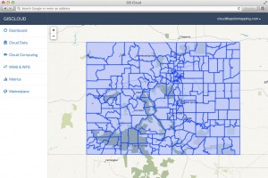
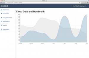
Some of you may have used other GIS cloud services in the past, and in many ways the GISrack will be similar to these. But the GISrack will distinguish itself in a variety of important manners. Here is a list of the key features that will be unique to the GISrack:
- Near-instant set-up–unlike other GIS clouds, the GISrack will take less than five minutes to sign up for, load data on to and get started using. No other cloud comes close to that flexibility.
- Tons of free spatial data–included with every subscription is access to more than 4 terabytes (TB) of free vector and raster data covering the United States and many parts of the world.
- A marketplace for spatial data – all users will have access to a library of spatial data that can be added to your GIS cloud. Further, users will be able to post data they have created to the marketplace to sell to other users (or let them use for free if you wish).
- Cloud computing – we will ask all users for feedback on the spatial operations they perform most frequently and will then implement the most popular ones in the GISrack.
- Free entry-level subscriptions – users will be able to use the full-functionality of the GISrack with up to 25 megabytes (MB) of free storage and bandwidth. And once you pass this storage limit, subscriptions will start at just $5.00 per month!
- A robust online viewer–for those users in your organization lacking access to a GIS application, the GISrack will feature an online viewer that can be accessed from anywhere in the world as long as users have internet access.
- Enhanced browsing speeds – we will have all of your spatial data cached in multiple locations around the world so access times will be greatly reduced for international users.
- Flexible streaming architecture – administrators will be able to setup multiple WMS and WFS feeds that can be shared with the appropriate teams of data users. Each feed can be seeded with the datasets these users need access to.
- Industry-leading data redundancy – with 99.999999999% data redundancy, you can be assured that your data will not be lost once placed on the GISrack.
Do you have any specific questions you would like answered about the GISrack? Or perhaps you want to join the beta program? If so, let us know by email at sales@apollomapping.com.
For three years, Airbus’ twin high-resolution radar satellites, TerraSar-X and TanDEM-X, have imaged the entire land surface of our planet multiple times to create the first ever global 12-meter (m) elevation model. The WorldDEM is ideal for all mapping projects requiring accurate elevation models including orthorectification, floodplain determination, mineral exploration and hydrocarbon development.
 A comparison of 30-m SRTM and 12-m WorldDEMTM elevation data over Arkansas, USA.
WorldDEM January 2015 Product Updates
During January, sections of Asia, Europe, the Middle East and South America were made available. Areas that are available take a minimum of 10 days to deliver.
To date, there is more than 66,311,000 square kilometers (sq km) of WorldDEM data that is available! And some 7,948,000 sq km of WorldDEM was made available for delivery in the past month.
WorldDEM Specifications
The key product specifications of Airbus’ WorldDEM are as follows:
- Resolution: 12-m
- Coverage: entire landmass of the Earth, ~150 million square kilometers (sq km)
- Absolute Vertical Accuracy: < 4-m Linear Error 90% (LE90)
- Relative Vertical Accuracy: < 2-m LE90 (slopes ≤ 20%), < 4-m LE90 (slopes > 20%)
- Absolute Horizontal Accuracy: < 10-m Circular Error 90% (CE90)
- Vintage: all data collected within 3 years
- Source: interferometry from synthetic aperture radar (SAR) satellites TerraSAR-X & TanDEM-X
- Minimum Order: 500 sq km per polygon
- File Format: GeoTIFF
- Projection: geographic WGS84 (EGM2008, vertical datum), meter vertical unit
- Product Line Options:
- WorldDEMcore–unedited digital surface model (DSM), includes spikes, wells and voids
- WorldDEM–a DSM with removal of artifacts and water body flattening
- WorldDEM DTM–artifacts and surface features removed, i.e. a digital terrain model (DTM)
 A coverage map of the one-degree cells that are currently available for delivery. Areas that are available will take a minimum of 10 days to deliver.
WorldDEM Coverage and Pricing
WorldDEM data has a 500 sq km minimum order size with a 10-km width requirement. Prices for two of the product lines have been set:
- WorldDEMcore–$10.80 per sq km
- WorldDEMTM–$13.50 per sq km
WorldDEM Samples
You can download three 12-m WorldDEMTM samples here:
- Buraydah, Saudi Arabia–desert with agriculture present; 576 m to 737 m
- Mjosa Lake, Norway–hilly terrain with large water bodies; 100 m to 840 m
- Wagga Wagga, Australia–forest and urban with many water bodies; 137 m to 922 m
For more information about 12-m WorldDEM data, please send us an email at sales@apollomapping.com.
 An example of a free dataset you can find through the Stanford Libraries free GIS data website. This dizzying map divides the world along ethnic group boundaries. The original dataset contains more than 8,900 individual polygons! (Data Credit: Swiss Federal Institute of Technology Zurich)
It has been a bit since I featured a collection of free spatial datasets in my Free For All so it is time to break this streak! Here is a link to an excellent collection of raster and vector layers that span our globe put together by the fine folks at Stanford University Libraries. This collection of GIS data is broken out first by region and then by theme such as energy, land cover, society and more. This is one impressive collection of free data to say the least! One thing to note is that many of the datasets will require you to register in order to download them.
Until my next edition of the Free For All, happy hunting for free geospatial goodies!
Brock Adam McCarty
Map Wizard
(720) 470-7988
brock@apollomapping.com
I may be jumping the gun on this article by discussing our partner DigitalGlobe’s Basemap Refresh program for the US since we are still working diligently on adding a subscription services page to our website; but this is an important topic to think about now as we start the New Year. Most people I speak to haven’t heard about the US Basemap Refresh program so here is a high level overview.
 A field next to a new development in Longmont, CO imaged on November 17, 2013 by the 50-cm color satellite, WorldView-2. (Image Courtesy: DigitalGlobe)
 The same field with new construction next to a new development in Longmont, CO imaged on November 6, 2014 by the 30-cm color satellite, WorldView-3. Image resolution online is currently 40cm with WorldView-3 by US government regulation. (Image Courtesy: DigitalGlobe)
Our valued partner, DigitalGlobe, has focused on and will continue to focus on collecting high-resolution imagery over all 50 states plus the US territories. The primary sensors being used to collect the imagery have 40-cm and 50-cm resolutions respectively with secondary sensors up to 80-cm. The main goal of these collections is to establish an ongoing basemap with no pixel older than 12 months. One way to think about this type of basemap is a heat-map where imagery at the 12 month vintage will have a higher priority to collect and refresh versus much newer datasets.
What this means for counties such as the one I live in here in Colorado–where new construction is a constant–is they’ll be able to stay on top of their tax revenue without having to wait for a new aerial collect every 2 to 4 years. In addition, their Emergency Management department will be able to update their 911 basemaps as new imagery is collected, processed and ingested onto the service.
The multi-temporal content and the service in general is easily accessible via a password-protected web portal, a Web Mapping Service (WMS & WMTS) or via a plug-in for any OGC-compliant software. In my example above of the new development, the imagery was accessed via the Basemap Refresh service where I was able to see all of the metadata for every dataset available over my area of interest.
The Basemap Refresh service is not meant to replace a state, city or county’s aerial flights but rather to provide updated imagery for the ‘in-between years’ at a fraction of the cost.
To find out which subscription option is best for you and to schedule a demo of the service, please feel free to reach out to me directly. We can always check to see what the coverage looks like over your state, county or city during the demo of the Basemap Refresh service.
Robert O’Munneke
Chief of Sales
(703) 304-6425
Robert@apollomapping.com


 Three images of Ferrari World and the surrounding areas in Abu Dhabi, United Arab Emirates. In these samples, you can see the unrivaled clarity and color saturation that WorldView-3 can provide. 40-cm color imagery collected on September 24, 2014 has been photo enhanced by Apollo Mapping. (Images Courtesy: DigitalGlobe)
We cannot get enough of this amazing 40-cm WorldView-3 (WV3) data and we hope you agree! So this month, we feature three color images from Ferrari World, Abu Dhabi in the United Arab Emirates. If you have not heard of the recently-launched satellite, WorldView-3, here are the features that really set it apart from the competition:
- Improved Resolution
- Higher resolution means you can see more detail in WV3 imagery.
- Data collected at nadir will have 31-centimeter (cm) panchromatic, 1.24-meter (m) visible and near infrared, 3.7-m short-wave infrared and 30-m CAVIS bands.
- At 20 degrees off-nadir, the resolution is 34-cm panchromatic, 1.38-m visible and near infrared and 4.1-m short-wave infrared.
- With the easing of US government regulations, we will be able to provide WV3 imagery at a maximum of 30-cm resolution during Q1 2015.
- Additional Spectral Bands
- If spectral analysis is part of your project, then no other satellite can match WV3 with its: 8 bands of visible and near-infrared data; 8 shortwave infrared bands which are crucial for geological studies; and 12 CAVIS bands to detect water vapor, dissolved aerosols, snow, clouds and more.
- Better Positional Accuracy
- With accuracies of 3.5-m CE90% or better (without ground control even!), WV3 has no rivals for its enhanced positional accuracy.
- Daily Revisits
- At 40 degrees latitude, WV3 will be able to image each location daily with 1-meter or better resolution and then every 4.5 days at 34-cm resolution or better.
- Increased Collection Capacity
- WV3 features a 13.1-km swath width (at nadir) with the ability to collect up to 680,000 square kilometer (sq km) of high-resolution data per day.
- Improved control movement gyros translate into larger maximum contiguous collection areas per pass, with up to +/-7,500 sq km of mono imagery and +/-3,000 sq km of stereo possible.
If you are interested in WorldView-3 imagery for your next project, please let us know by phone, 303-993-3863, or by email, sales@apollomapping.com.
