BJ3N Satellite

4-band 30-cm high-resolution BJ3N imagery offers crisp views.

BJ3N Satellite Imagery Samples

BJ3N 30-cm Natural Color – Doha, Qatar; January 31, 2023

Click on the expand button for a larger view of each image. You can also right-click and save any of the examples to your computer for a full resolution view.


The BJ3N Advantage

4-Band Multispectral Imagery
BJ3N images include 1.2-meter (m) red, green, blue, and near-infrared (NIR) bands for multispectral analysis and change detection.

Crisp 30-cm Resolution
The BJ3N satellite enhances our 30-centimeter (cm) imagery offerings and grows our archive of exceptional-quality high-resolution imagery.

Impressive Collection Capacity
Collecting up to 500,000 square kilometers (sq km) a day, 30-cm BJ3N is amassing a sizeable archive of high-resolution satellite imagery.

Overview & HistoryBJ3N SpecificationsPricing

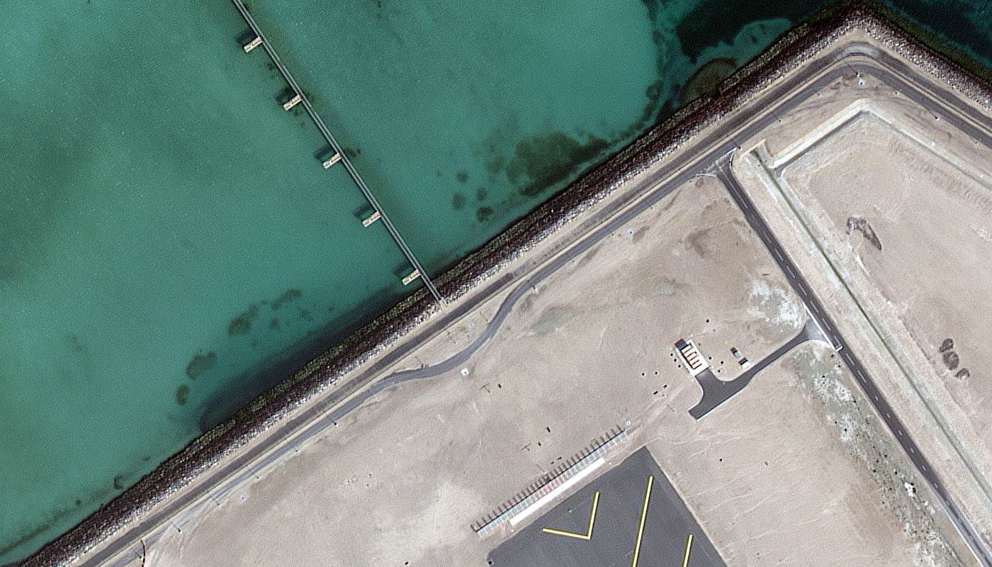
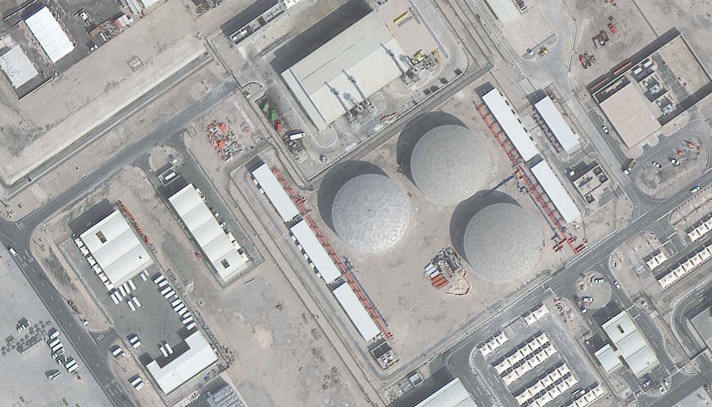
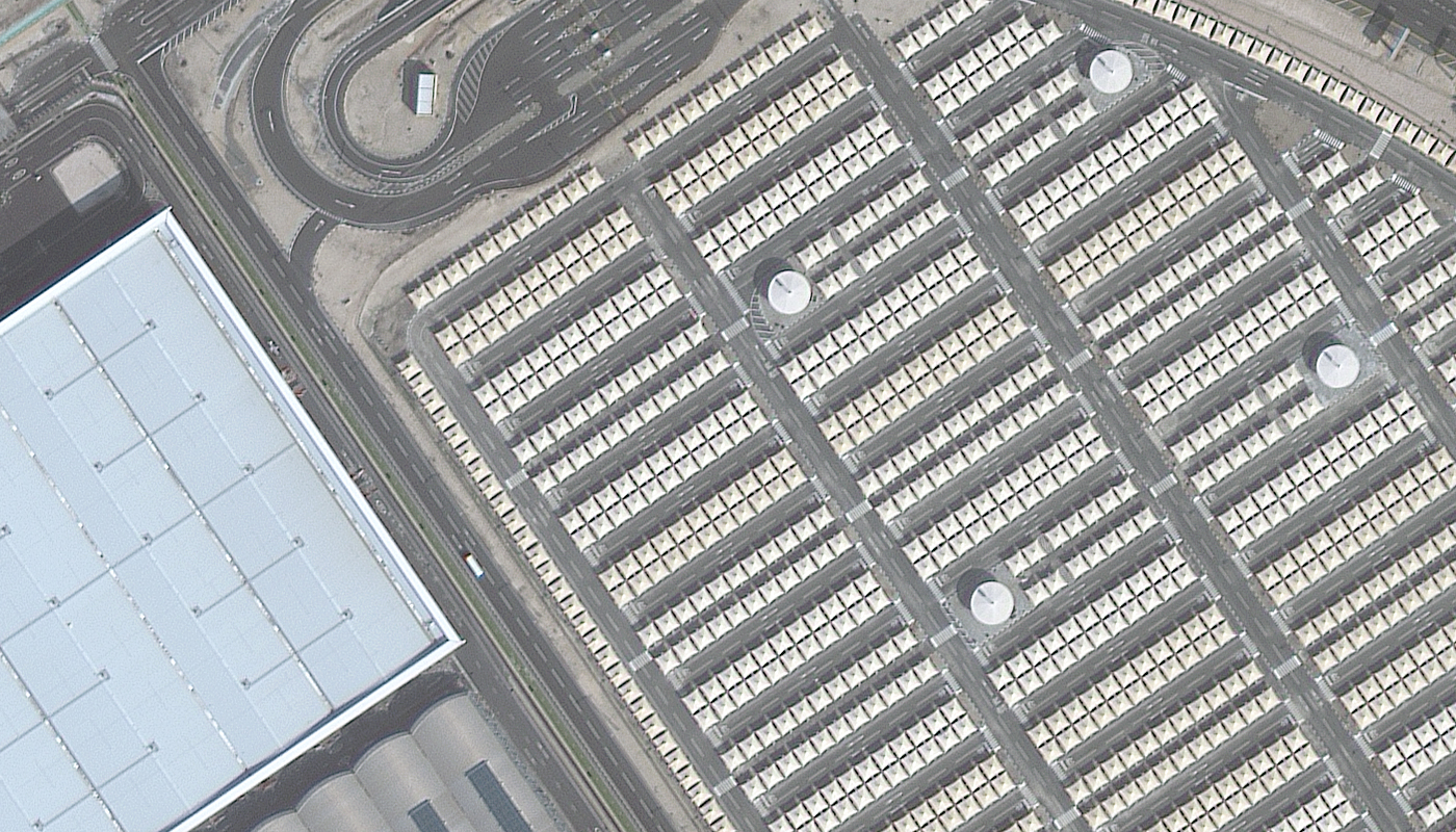
Launched into orbit aboard a Long March CZ-2D vehicle from Taiyuan, China on August 24, 2022, Twenty First Century Aerospace Technology’s BJ3N joins our pantheon of 30-cm high-resolution satellites. The panchromatic sensor collects imagery at 30-cm resolution, while the 4-band multispectral sensor, including blue, green, red, and near-infrared (NIR) spectral bands, collects at 1.2-m resolution. With an impressive daily collection capacity of 500,000 sq km, the BJ3N satellite rapidly images substantial areas of the Earth’s surface. Whether reviewing agricultural areas, monitoring urban growth, or analyzing environmental change, the BJ3N satellite offers considerable insights. With its powerful capabilities, BJ3N adds to our ever-growing archive of 30-cm resolution Earth imagery.

Launch Details
  • Launch Date: August 24, 2022, 03:01:00 UTC
  • Vehicle: Long March CZ-2D
  • Site: Taiyuan Satellite Launch Center, Taiyuan, China
  • Expected Mission Life: at least 8 years
Orbit Characteristics
  • Altitude: 610 km
  • Period: 96.08 minutes
  • Inclination: 97.942°
  • Direction: sun-synchronous circular, south to north (across the lit side of Earth)
  • Mean Local Crossing Time: 11:00 local time (approximate; across lit side of Earth)
  • Revisit Frequency: 5 days (≤ 45° off-nadir, at 40°N)
Imaging System
  • Spectral Bands:
    • Panchromatic
    • 4-band multispectral (blue, green, red and near-infrared red [NIR])
  • Sensor Resolution:
    • At nadir – 30-cm panchromatic & 1.2-m multispectral
    • 20° off-nadir – 34-cm panchromatic & 1.36-m multispectral
    • 50° off-nadir – 40-cm panchromatic & 1.60-m multispectral
  • Spectral Band Wavelength Range: (in nm)
    • Panchromatic – 450 to 900
    • Blue – 450 to 520
    • Green – 520 to 590
    • Red – 630 to 690
    • NIR – 770 to 890
  • Dynamic Range: 11-bits
Collection Capabilities
  • Footprint Width: 11.5 km (at nadir)
  • Single Pass Maximum Collection Geometry: (width x length)
    • Mono – 70 km x 70 km (7 strips wide)
    • Stereo – 22 km x 70 km (2 pairs wide)
  • Daily Collection Capacity: 500,000 sq km
  • Georeferenced Horizontal Accuracy: < 10-m CE90 (global average, dependent on terrain)

Below is the least expensive BJ3N data offered. Prices increase for new collections, stereo imagery and data processing. Note that volume discounts are available.

  • Data Source: archive
  • Minimum Order Size: 25 sq km (per area & date)
  • Product Type: 30-cm georeferenced + natural color or 4-band
  • Price Per Sq Km: $16.00 (more detailed pricing can be found here)

For an exact quote, please contact our Sales Team at sales@apollomapping.com.

Looking for a BJ3N spectral response curve to be used in an atmospheric correction and/or radiance conversion?

Download Whitepaper


Browse Other Satellites